Request a quote

5-Day Toubkal and Ouanoukrim Trek via the Imenane Valley

Two low days of villages, a night in Aroumd, two nights at the refuge with the second-highest mountain in North Africa between them, and Toubkal on the fifth morning: the gentlest road we know to both 4,000 m summits.

5 days4 nights — Amsakrou, Aroumd, refuge ×2
4,167 mSummit / Highest Point
51–56 kmTotal Distance
+4,285 mTotal Ascent (D+/D−)
StrenuousFitness Grade
All yearRecommended Season
The 5-Day Toubkal and Ouanoukrim Trek via the Imenane Valley is the best-acclimatised route to two 4,000 m summits in our programme. Days one and two cross the low Tizi n'Aguersioual into the Imenane for a night in the village of Amsakrou, then follow the valley and cross Tizi n'Tamatert (2,279 m) to Aroumd (1,900 m); day three climbs the normal route past Sidi Chamharouch to the mountain refuge at 3,207 m; day four climbs Tizi n'Ouagane (3,750 m) and the broken ridge to the twin summits of Ouanoukrim — Timesguida (4,089 m) and Ras Ouanoukrim (4,083 m) — and returns to the refuge; day five takes the Ikhibi Sud to Toubkal (4,167 m) before dawn and descends to Imlil. About 51–56 km and 4,285 m of ascent — strenuous on the two summit days, non-technical in summer, a guided winter ascent from November to April. A licensed mountain guide, private transfers from Marrakech, four nights, full board and mineral water are included, from €420 per person. The two-summit programme with the gentlest profile in our Atlas treks range, inside the Toubkal National Park (established 1942).
The route, drawn to scale

Day-by-day mountain route

Tap a day to trace it. Your certified guide sets the pace and monitors acclimatization throughout.

1,500 2,000 2,500 3,000 3,500 4,000 4,500 alt m Aguersioual 1,680 m Tizi n'Aguersioual Amsakrou — night 1 Tizi n'Tamatert Aroumd — night 2 Sidi Chamharouch Refuge — night 3 Tizi n'Ouagane Ouanoukrim 4,089 m Refuge — night 4 Toubkal 4,167 m Imlil 1,740 m 1,500 2,000 2,500 3,000 3,500 4,000 4,500 Aguersioual 1,680 m Ouanoukrim 4,089 m Toubkal 4,167 m Imlil 1,740 m

Aguersioual — Tizi n'Aguersioual — Amsakrou

Day 1
5–6 km distance +350 m / −330 m elevation 3–3½ h walking

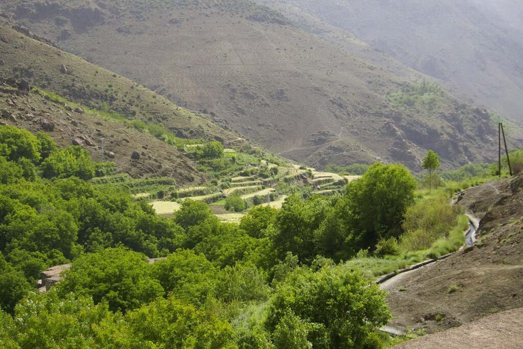
Pickup from your Marrakech riad and a drive of about 1 h 20 to Aguersioual, a village on the Asni–Imlil road at roughly 1,680 m, where you meet your guide and muleteer. The path leaves the road eastwards and climbs a dry side valley on a mule track between scattered junipers and rocky outcrops; the gradient is moderate and the pass of Tizi n'Aguersioual, at around 1,900 m, is reached in little more than an hour. The col is the first viewpoint of the trek: the Imenane valley below with its terraced villages on the opposite slope, the bulk of Jbel Oukaimeden closing the view to the north-east, and to the south the Toubkal massif above the ridge of Tizi n'Tamatert — the mountain you will stand on in three days' time. A short zigzag descent reaches the valley floor and the village of Amsakrou at about 1,700 m, set among irrigated terraces of barley, maize and walnut above the river. The walk is over by early afternoon, by design: this is the first of two easy days meant to settle the legs and start the body's adjustment to altitude.

Overnight & Meals: Night 1: traditional mountain guesthouse or family home in Amsakrou (c. 1,700 m), selected by Imlil Trek. Meals: lunch in the village, home-cooked dinner. Optional: an afternoon stroll along the valley.

Amsakrou — Ikkiss — Tinerhourhine — Tizi n'Tamatert — Tamatert — Aroumd

Day 2
13–14 km distance +750 m / −550 m elevation 6–7 h walking

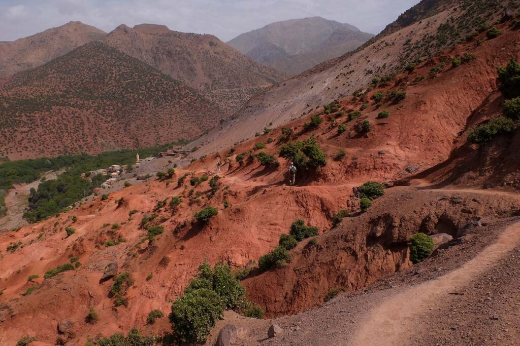
The second day follows the Imenane valley upstream on the mule path that joins its villages. From Amsakrou the route passes through the terraces to Ikkiss, a cluster of earth-built houses on the slope, and continues to Tinerhourhine, facing the larger village of Ouanskra across the river, with Tacheddirt — the highest village in the range — visible at the valley head. The path then leaves the valley floor and climbs south-west through Aleppo pine and juniper in steady zigzags to Tizi n'Tamatert (2,279 m), the pass that links the Imenane to the Imlil valley, and the natural lunch stop: the Toubkal massif fills the view to the south and the Imlil valley lies spread out below. The descent follows the well-made track down to the village of Tamatert and through the walnut terraces of Aït Souka, but instead of dropping into Imlil the route crosses the stream and continues south along the valley to Aroumd, the largest village of the Mizane, climbing its stone steps to the houses on the rocky spur at 1,900 m, with the north face of Toubkal at the head of the valley.

Overnight & Meals: Night 2: traditional mountain guesthouse in Aroumd (1,900 m), selected by Imlil Trek — rooms, a terrace facing the mountain, home-cooked dinner. Meals: breakfast at the guesthouse, picnic lunch at the pass, dinner at the guesthouse.

Aroumd — Sidi Chamharouch — mountain refuge

Day 3
+1,320 m / −15 m elevation 4½–5½ h walking

From Aroumd the path drops onto the broad flood plain of the Assif n'Ait Mizane, a pale expanse of river boulders crossed on cairned paths, and follows the left bank southwards. The gradient is gentle at first, then steepens into long zigzags above the river to the hamlet of Sidi Chamharouch at 2,350 m, where a white marabout's shrine stands beneath a huge boulder beside a small waterfall; the shrine is reserved for Muslim visitors, but the stalls sell mint tea, juice and snacks and this is the usual lunch stop. A footbridge crosses the stream and the path continues on the opposite bank, now above the tree line, through rocky pasture with Toubkal's north face growing ahead. The final hour is a steady climb to the stone refuges at 3,207 m, set in a cirque beneath the mountain. An early dinner and an early night follow: the summit push starts in the dark.

Overnight & Meals: Night 3: mountain refuge at 3,207 m, selected by Imlil Trek — dormitory-style, blankets, hot dinner. Meals: breakfast at the guesthouse, lunch at Sidi Chamharouch, dinner at the refuge. This is base camp for two nights.

Refuge — Tizi n'Ouagane — Ras Ouanoukrim and Timesguida — refuge

Day 4
8–9 km distance +900 m / −900 m elevation 5½–7 h walking

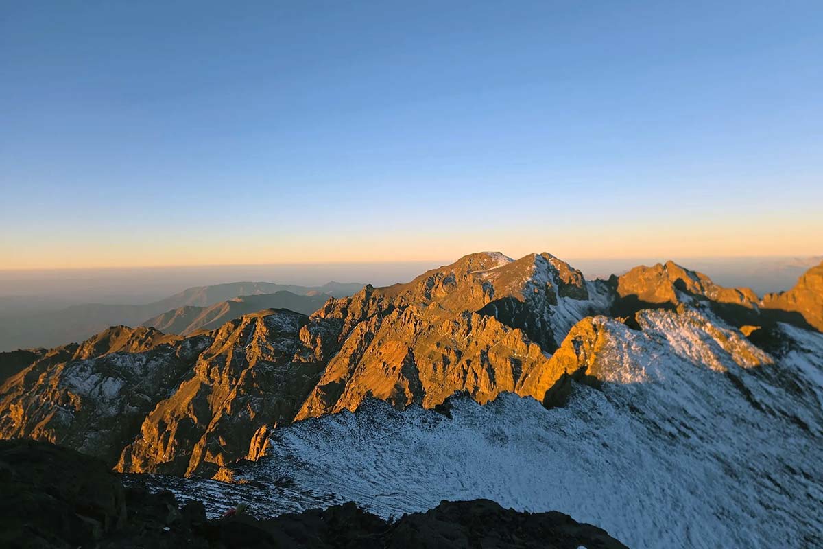
The acclimatisation summit — and the second-highest mountain in North Africa. The path leaves the cirque westwards up the Ouagane valley, a long bowl of scree and boulders south of the refuges, rising steadily on cairned paths to the col of Tizi n'Ouagane at about 3,750 m, two to two and a half hours above the refuge, with the view opening south over the Anti-Atlas and Jbel Siroua. From the col the broken rocky ridge of Ouanoukrim leads to its two tops in turn: Ras Ouanoukrim (4,083 m), the nearer, and Timesguida (4,089 m), the higher, a short distance beyond — rough walking on shattered rock with no scrambling in summer, and a summit view that puts Toubkal directly across the cirque, with the whole line of tomorrow's climb visible on its western flank. Lunch is taken on the ridge or back at the col, and the descent follows the same way to the refuge, usually by mid-afternoon, leaving the rest of the day to rest and eat before the early start.

Overnight & Meals: Night 4: mountain refuge at 3,207 m, as before. Meals: breakfast and dinner at the refuge, picnic on the mountain. Water: none above the refuge — carry two to three litres. Bad weather: the day becomes a rest or short acclimatisation walk; Toubkal follows as planned.

Refuge — Ikhibi Sud — Toubkal summit — Sidi Chamharouch — Aroumd — Imlil

Day 5
17–19 km distance +965 m / −2,430 m elevation 8½–10 h walking

The day begins at around 04:30–05:30 with a head torch. Directly behind the refuges the path crosses the stream and climbs into the Ikhibi Sud, the south cwm, a steep bowl of scree and boulders, zigzagging up its right-hand side on a loose but well-trodden path. The gradient eases where the cwm opens onto a shoulder, and a rising traverse reaches the col of Tizi n'Toubkal at roughly 3,940 m. From the col the summit crest leads north-east over broken rock to the iron pyramid at 4,167 m, usually three to four hours after leaving the refuge — and, after two nights at 3,207 m and a 4,000 m summit the day before, felt less than on any other programme. The panorama takes in Ouanoukrim, where you stood yesterday, and the whole High Atlas ridge, the Anti-Atlas and Jbel Siroua to the south, the Haouz plain to the north — and, closer, the ridge of Oukaimeden and the Imenane valley you walked through on the first two days. The descent to the refuge takes about two hours on the loose scree. After a second breakfast the walk back down the Mizane valley through Sidi Chamharouch and Aroumd to Imlil takes another three to four hours, where your driver waits. In winter the whole cwm is on snow and ice and crampons and an ice axe are used from the refuge.

Overnight & Meals: Meals: pre-dawn breakfast and a second breakfast at the refuge, packed lunch on the descent. Back in Marrakech: around 5–6 pm. Nov–Apr: crampons and ice axe from the refuge; the guide sets the turnaround time.
AAAWgmp1bWIAAAAeanVtZGMycGEAEQAQgAAAqgA4m3EDYzJwYQAAABZcanVtYgAAAEdqdW1kYzJtYQARABCAAACqADibcQN1cm46YzJwYTo0NTcyYWQyMy1mNTM2LTRjNWQtOTI0NC1hMDYwOWU3NTYzZDUAAAADl2p1bWIAAAApanVtZGMyYXMAEQAQgAAAqgA4m3EDYzJwYS5hc3NlcnRpb25zAAAAALxqdW1iAAAARGp1bWRjYm9yABEAEIAAAKoAOJtxE2MycGEuaW5ncmVkaWVudC52MwAAAAAYYzJzaK9iMWRnHlaakVrvro7NDOEAAABwY2JvcqNpZGM6Zm9ybWF0bWltYWdlL3N2Zyt4bWxqaW5zdGFuY2VJRHgseG1wOmlpZDo0MTAwOTBhZS0xOGYxLTRjYWMtODlhNy1hNDljYzhhZjRiNmRscmVsYXRpb25zaGlwaHBhcmVudE9mAAAB4mp1bWIAAABBanVtZGNib3IAEQAQgAAAqgA4m3ETYzJwYS5hY3Rpb25zLnYyAAAAABhjMnNopB7DEN3ddTAULC4KZpK5NQAAAZljYm9yomdhY3Rpb25zgqJmYWN0aW9ua2MycGEub3BlbmVkanBhcmFtZXRlcnOha2luZ3JlZGllbnRzgaJjdXJseC1zZWxmI2p1bWJmPWMycGEuYXNzZXJ0aW9ucy9jMnBhLmluZ3JlZGllbnQudjNkaGFzaFggNHaeycZ7cWGKxWv3akn/2au7YpmWc1mHtU6njVt12OKkZmFjdGlvbngdY29tLmFudGhyb3BpYy5jbGF1ZGUucHJvdmlkZWRqcGFyYW1ldGVyc6F4H2NvbS5hbnRocm9waWMub3JpZ2luLWNvbmZpZGVuY2VndW5rbm93bmtkZXNjcmlwdGlvbnhmQ2xhdWRlIHByb3ZpZGVkIHRoaXMgZmlsZSBhdCB0aGUgcmVxdWVzdCBvZiBhIHVzZXIgYW5kIG1heSBoYXZlIGNyZWF0ZWQgb3IgbW9kaWZpZWQgdGhlIGZpbGUgY29udGVudHMubXNvZnR3YXJlQWdlbnShZG5hbWVmQ2xhdWRlcmFsbEFjdGlvbnNJbmNsdWRlZPUAAADIanVtYgAAAEBqdW1kY2JvcgARABCAAACqADibcRNjMnBhLmhhc2guZGF0YQAAAAAYYzJzaIsBtZWCHEkRxVzaktBZ+fgAAACAY2JvcqVjYWxnZnNoYTI1NmNwYWRNAAAAAAAAAAAAAAAAAGRoYXNoWCA6hzhj/VbYKTSaYFnfDv9OXrt8qPqtlN4CpELwr8XBeWRuYW1lbmp1bWJmIG1hbmlmZXN0amV4Y2x1c2lvbnOBomVzdGFydBjSZmxlbmd0aBkeBAAAAj5qdW1iAAAAJ2p1bWRjMmNsABEAEIAAAKoAOJtxA2MycGEuY2xhaW0udjIAAAACD2Nib3KlY2FsZ2ZzaGEyNTZpc2lnbmF0dXJleE1zZWxmI2p1bWJmPS9jMnBhL3VybjpjMnBhOjQ1NzJhZDIzLWY1MzYtNGM1ZC05MjQ0LWEwNjA5ZTc1NjNkNS9jMnBhLnNpZ25hdHVyZWppbnN0YW5jZUlEeCx4bXA6aWlkOmE5ZWNjOTIwLWY5NTYtNDMwMS1hODA1LWZhZWIyNDE1NGEyMHJjcmVhdGVkX2Fzc2VydGlvbnODomN1cmx4LXNlbGYjanVtYmY9YzJwYS5hc3NlcnRpb25zL2MycGEuaW5ncmVkaWVudC52M2RoYXNoWCA0dp7JxntxYYrFa/dqSf/Zq7timZZzWYe1TqeNW3XY4qJjdXJseCpzZWxmI2p1bWJmPWMycGEuYXNzZXJ0aW9ucy9jMnBhLmFjdGlvbnMudjJkaGFzaFggVf2PJWN99AHgYk15rsjgS2Z3YKlo9rd9jcJ/s14DMY2iY3VybHgpc2VsZiNqdW1iZj1jMnBhLmFzc2VydGlvbnMvYzJwYS5oYXNoLmRhdGFkaGFzaFggFkurQW9f2Avh6unKT9dgJ41VN+8U/khnRlbWDF6A/ZV0Y2xhaW1fZ2VuZXJhdG9yX2luZm+jZG5hbWVvQW50aHJvcGljIEZpbGVzZ3ZlcnNpb25lMS4wLjBrc3BlY1ZlcnNpb25lMi40LjAAABA4anVtYgAAAChqdW1kYzJjcwARABCAAACqADibcQNjMnBhLnNpZ25hdHVyZQAAABAIY2JvctKEWQISogEmGCFZAgowggIGMIIBjaADAgECAhRA5aAK7sI50L64g/oGQgU9Z1UTADAKBggqhkjOPQQDAzBJMRcwFQYDVQQKEw5BbnRocm9waWMsIFBCQzEuMCwGA1UEAxMlQW50aHJvcGljIENvbnRlbnQgQ3JlZGVudGlhbHMgUm9vdCBDQTAeFw0yNjA4MDcxODQzNTZaFw0yODA4MDYxOTQzNTZaMEQxFzAVBgNVBAoTDkFudGhyb3BpYywgUEJDMSkwJwYDVQQDEyBBbnRocm9waWMgQ2xhdWRlIENvbnRlbnQgU2lnbmluZzBZMBMGByqGSM49AgEGCCqGSM49AwEHA0IABJh6CmvLUBgFFNU0vUKlOVtE6djd17L5SuwX0LemFisBM3dkd/3cyjxFA3Qo5S46fX0/ihY0VZ7mfb9KF703t5OjWDBWMA4GA1UdDwEB/wQEAwIHgDAVBgNVHSUEDjAMBgorBgEEAYPoXgIBMAwGA1UdEwEB/wQCMAAwHwYDVR0jBBgwFoAUzlHiBIFOZFsj+OPEz5o+nMHXXMIwCgYIKoZIzj0EAwMDZwAwZAIwMXMdFJ4BetLLVY7ORuE9noqbbAZOZn/aArXyTwFAZfKrPzxF2vPoJNf1+UCdg1XGAjBwX1zd9WGqYkqmL5SFqw1QySjr1zJfpJM9+1rdDwSPLMOPOjKuiXjoU/pUUeG9RwmhY3BhZFkNngAAAAAAAAAAAAAAAAAAAAAAAAAAAAAAAAAAAAAAAAAAAAAAAAAAAAAAAAAAAAAAAAAAAAAAAAAAAAAAAAAAAAAAAAAAAAAAAAAAAAAAAAAAAAAAAAAAAAAAAAAAAAAAAAAAAAAAAAAAAAAAAAAAAAAAAAAAAAAAAAAAAAAAAAAAAAAAAAAAAAAAAAAAAAAAAAAAAAAAAAAAAAAAAAAAAAAAAAAAAAAAAAAAAAAAAAAAAAAAAAAAAAAAAAAAAAAAAAAAAAAAAAAAAAAAAAAAAAAAAAAAAAAAAAAAAAAAAAAAAAAAAAAAAAAAAAAAAAAAAAAAAAAAAAAAAAAAAAAAAAAAAAAAAAAAAAAAAAAAAAAAAAAAAAAAAAAAAAAAAAAAAAAAAAAAAAAAAAAAAAAAAAAAAAAAAAAAAAAAAAAAAAAAAAAAAAAAAAAAAAAAAAAAAAAAAAAAAAAAAAAAAAAAAAAAAAAAAAAAAAAAAAAAAAAAAAAAAAAAAAAAAAAAAAAAAAAAAAAAAAAAAAAAAAAAAAAAAAAAAAAAAAAAAAAAAAAAAAAAAAAAAAAAAAAAAAAAAAAAAAAAAAAAAAAAAAAAAAAAAAAAAAAAAAAAAAAAAAAAAAAAAAAAAAAAAAAAAAAAAAAAAAAAAAAAAAAAAAAAAAAAAAAAAAAAAAAAAAAAAAAAAAAAAAAAAAAAAAAAAAAAAAAAAAAAAAAAAAAAAAAAAAAAAAAAAAAAAAAAAAAAAAAAAAAAAAAAAAAAAAAAAAAAAAAAAAAAAAAAAAAAAAAAAAAAAAAAAAAAAAAAAAAAAAAAAAAAAAAAAAAAAAAAAAAAAAAAAAAAAAAAAAAAAAAAAAAAAAAAAAAAAAAAAAAAAAAAAAAAAAAAAAAAAAAAAAAAAAAAAAAAAAAAAAAAAAAAAAAAAAAAAAAAAAAAAAAAAAAAAAAAAAAAAAAAAAAAAAAAAAAAAAAAAAAAAAAAAAAAAAAAAAAAAAAAAAAAAAAAAAAAAAAAAAAAAAAAAAAAAAAAAAAAAAAAAAAAAAAAAAAAAAAAAAAAAAAAAAAAAAAAAAAAAAAAAAAAAAAAAAAAAAAAAAAAAAAAAAAAAAAAAAAAAAAAAAAAAAAAAAAAAAAAAAAAAAAAAAAAAAAAAAAAAAAAAAAAAAAAAAAAAAAAAAAAAAAAAAAAAAAAAAAAAAAAAAAAAAAAAAAAAAAAAAAAAAAAAAAAAAAAAAAAAAAAAAAAAAAAAAAAAAAAAAAAAAAAAAAAAAAAAAAAAAAAAAAAAAAAAAAAAAAAAAAAAAAAAAAAAAAAAAAAAAAAAAAAAAAAAAAAAAAAAAAAAAAAAAAAAAAAAAAAAAAAAAAAAAAAAAAAAAAAAAAAAAAAAAAAAAAAAAAAAAAAAAAAAAAAAAAAAAAAAAAAAAAAAAAAAAAAAAAAAAAAAAAAAAAAAAAAAAAAAAAAAAAAAAAAAAAAAAAAAAAAAAAAAAAAAAAAAAAAAAAAAAAAAAAAAAAAAAAAAAAAAAAAAAAAAAAAAAAAAAAAAAAAAAAAAAAAAAAAAAAAAAAAAAAAAAAAAAAAAAAAAAAAAAAAAAAAAAAAAAAAAAAAAAAAAAAAAAAAAAAAAAAAAAAAAAAAAAAAAAAAAAAAAAAAAAAAAAAAAAAAAAAAAAAAAAAAAAAAAAAAAAAAAAAAAAAAAAAAAAAAAAAAAAAAAAAAAAAAAAAAAAAAAAAAAAAAAAAAAAAAAAAAAAAAAAAAAAAAAAAAAAAAAAAAAAAAAAAAAAAAAAAAAAAAAAAAAAAAAAAAAAAAAAAAAAAAAAAAAAAAAAAAAAAAAAAAAAAAAAAAAAAAAAAAAAAAAAAAAAAAAAAAAAAAAAAAAAAAAAAAAAAAAAAAAAAAAAAAAAAAAAAAAAAAAAAAAAAAAAAAAAAAAAAAAAAAAAAAAAAAAAAAAAAAAAAAAAAAAAAAAAAAAAAAAAAAAAAAAAAAAAAAAAAAAAAAAAAAAAAAAAAAAAAAAAAAAAAAAAAAAAAAAAAAAAAAAAAAAAAAAAAAAAAAAAAAAAAAAAAAAAAAAAAAAAAAAAAAAAAAAAAAAAAAAAAAAAAAAAAAAAAAAAAAAAAAAAAAAAAAAAAAAAAAAAAAAAAAAAAAAAAAAAAAAAAAAAAAAAAAAAAAAAAAAAAAAAAAAAAAAAAAAAAAAAAAAAAAAAAAAAAAAAAAAAAAAAAAAAAAAAAAAAAAAAAAAAAAAAAAAAAAAAAAAAAAAAAAAAAAAAAAAAAAAAAAAAAAAAAAAAAAAAAAAAAAAAAAAAAAAAAAAAAAAAAAAAAAAAAAAAAAAAAAAAAAAAAAAAAAAAAAAAAAAAAAAAAAAAAAAAAAAAAAAAAAAAAAAAAAAAAAAAAAAAAAAAAAAAAAAAAAAAAAAAAAAAAAAAAAAAAAAAAAAAAAAAAAAAAAAAAAAAAAAAAAAAAAAAAAAAAAAAAAAAAAAAAAAAAAAAAAAAAAAAAAAAAAAAAAAAAAAAAAAAAAAAAAAAAAAAAAAAAAAAAAAAAAAAAAAAAAAAAAAAAAAAAAAAAAAAAAAAAAAAAAAAAAAAAAAAAAAAAAAAAAAAAAAAAAAAAAAAAAAAAAAAAAAAAAAAAAAAAAAAAAAAAAAAAAAAAAAAAAAAAAAAAAAAAAAAAAAAAAAAAAAAAAAAAAAAAAAAAAAAAAAAAAAAAAAAAAAAAAAAAAAAAAAAAAAAAAAAAAAAAAAAAAAAAAAAAAAAAAAAAAAAAAAAAAAAAAAAAAAAAAAAAAAAAAAAAAAAAAAAAAAAAAAAAAAAAAAAAAAAAAAAAAAAAAAAAAAAAAAAAAAAAAAAAAAAAAAAAAAAAAAAAAAAAAAAAAAAAAAAAAAAAAAAAAAAAAAAAAAAAAAAAAAAAAAAAAAAAAAAAAAAAAAAAAAAAAAAAAAAAAAAAAAAAAAAAAAAAAAAAAAAAAAAAAAAAAAAAAAAAAAAAAAAAAAAAAAAAAAAAAAAAAAAAAAAAAAAAAAAAAAAAAAAAAAAAAAAAAAAAAAAAAAAAAAAAAAAAAAAAAAAAAAAAAAAAAAAAAAAAAAAAAAAAAAAAAAAAAAAAAAAAAAAAAAAAAAAAAAAAAAAAAAAAAAAAAAAAAAAAAAAAAAAAAAAAAAAAAAAAAAAAAAAAAAAAAAAAAAAAAAAAAAAAAAAAAAAAAAAAAAAAAAAAAAAAAAAAAAAAAAAAAAAAAAAAAAAAAAAAAAAAAAAAAAAAAAAAAAAAAAAAAAAAAAAAAAAAAAAAAAAAAAAAAAAAAAAAAAAAAAAAAAAAAAAAAAAAAAAAAAAAAAAAAAAAAAAAAAAAAAAAAAAAAAAAAAAAAAAAAAAAAAAAAAAAAAAAAAAAAAAAAAAAAAAAAAAAAAAAAAAAAAAAAAAAAAAAAAAAAAAAAAAAAAAAAAAAAAAAAAAAAAAAAAAAAAAAAAAAAAAAAAAAAAAAAAAAAAAAAAAAAAAAAAAAAAAAAAAAAAAAAAAAAAAAAAAAAAAAAAAAAAAAAAAAAAAAAAAAAAAAAAAAAAAAAAAAAAAAAAAAAAAAAAAAAAAAAAAAAAAAAAAAAAAAAAAAAAAAAAAAAAAAAAAAAAAAAAAAAAAAAAAAAAAAAAAAAAAAAAAAAAAAAAAAAAAAAAAAAAAAAAAAAAAAAAAAAAAAAAAAAAAAAAAAAAAAAAAAAAAAAAAAAAAAAAAAAAAAAAAAAAAAAAAAAAAAAAAAAAAAAAAAAAAAAAAAAAAAAAAAAAAAAAAAAAAAAAAAAAAAAAAAAAAAAAAAAAAAAAAAAAAAAAAAAAAAAAAAAAAAAAAAAAAAAAAAAAAAAAAAAAAAAAAAAAAAAAAAAAAAAAAAAAAAAAAAAAAAAAAAAAAAAAAAAAAAAAAAAAAAAAAAAAAAAAAAAAAAAAAAAAAAAAAAAAAAAAAAAAAAAAAAAAAAAAAAAAAAAAAAAAAAAAAAAAAAAAAAAAAAAAAAAAAAAAAAAAAAAAAAAAAAAAAAAAAAAAAAAAAAAAAAAAAAAAAAAAAAAAAAAAAAAAAAAAAAAAAAAAAAAAAAAAAAAAAAAAAAAAAAAAAAAAAAAAAAAAAAAAAAAAAAAAAAAAAAAAAAAAAAAAAAAAAAAAAAAAAAAAAAAAAAAAAAAAAAAAAAAAAAAAAAAAAAAAAAAAAAAAAAAAAAAAAAAAAAAAAAAAAAAAAAAAAAAAAAAAAAAAAAAAAAAAAAAAAAAAAAAAAAAAAAAAAAAAAAAAAAAAAAAAAAAAAAAAAAAAAAAAAAAAAAAAAAAAAAAAAAAAAAAAAAAAAAAAAAAAAAAAAAAAAAAAAAAAAAAAAAAAAAAAAAAAAAAAAAAAAAAAAAAAAAAAAAAAAAAAAAAAAAAAAAAAAAAAAAAAAAAAAAAAAAAAAAAAAAAAAAAAAAAAAAAAAAAAAAAAAAAAAAAAAAAAAAAAAAAAAAAAAAAAAAAAAAAAAAAAAAAAAAAAAAAAAAAAAAAAAAAAAAAAAAAAAAAAAAAAAAAAAAAAAAAAAAAAAAAAAAAAAAAAAAAAAAAAAAAAAAAAAAAAAAAAAAAAAAAAAAAAAAAAAAAAAAAAAAAAAAAAAAAAAAAAAAAAAAAAAAAAAAAAAAAAAAAAAAAAAAAAAAAAAAAAAAAAAAAAAAAAAAAAPZYQJ+ZnK+lLq1JrfhnGFsxUSqstgrzMs+qx3xGZRuU782ma1k/Zg/mi4Z5irM4A4oZMsNZn33PAZbSHtqWPJaqmQ4= 31.04°N 31.06°N 31.08°N 31.10°N 31.12°N 31.14°N 31.16°N 31.18°N 7.96°W 7.94°W 7.92°W 7.90°W 7.88°W 7.86°W Aguersioual — start Aguersioual — start 1,680 m 1,680 m Tizi n'Aguersioual Tizi n'Aguersioual 1,900 m 1,900 m 1 Amsakrou — night 1 Amsakrou — night 1 1,700 m 1,700 m Ikkiss Ikkiss 1,850 m 1,850 m Tinerhourhine Tinerhourhine 1,900 m 1,900 m Tizi n'Tamatert Tizi n'Tamatert 2,279 m 2,279 m Tamatert Tamatert 1,810 m 1,810 m Aït Souka Aït Souka 1,800 m 1,800 m 2 Aroumd — night 2 Aroumd — night 2 1,900 m 1,900 m Sidi Chamharouch Sidi Chamharouch 2,350 m 2,350 m 3 Toubkal refuges — night 3 Toubkal refuges — night 3 3,207 m 3,207 m Tizi n'Ouagane Tizi n'Ouagane 3,750 m 3,750 m Ras Ouanoukrim Ras Ouanoukrim 4,083 m 4,083 m Timesguida Timesguida 4,089 m 4,089 m 4 Toubkal refuges — night 4 Toubkal refuges — night 4 3,207 m 3,207 m Tizi n'Toubkal Tizi n'Toubkal 3,940 m 3,940 m Jbel Toubkal Jbel Toubkal 4,167 m 4,167 m Imlil — finish Imlil — finish 1,740 m 1,740 m Day 1 Day 2 Day 3 Day 4 Day 5 IMLIL TREK · ROUTE MAP 25 5-Day Toubkal and Ouanoukrim Trek via the Imenane Valley Point-to-point · 51–56 km · +4,285 m · 5 days · north up N 0 5 km Start / finish Overnight stop (numbered) Pass Summit / highest point Waypoint Walking route (direction arrows) Schematic map, north up. Waypoints are plotted at their map coordinates; the line between them is smoothed and does not show every bend of the path. Verify against the GPX track before publication. © 2026 Imlil Trek by Extra Mile. Click to enlarge
Route map: 5-Day Toubkal and Ouanoukrim Trek via the Imenane Valley. The Mizane and Toubkal stages are GPS-verified; the Imenane days and the Ouanoukrim round are estimated.
Technical specifications

The numbers behind the day

Figures are marked by how they were obtained: GPS-verified from a recorded track, estimated from measured segments, or still to be verified on the ground.

 Day 1 — to AmsakrouDay 2 — to AroumdDay 3 — to the refugeDay 4 — OuanoukrimDay 5 — Toubkal and downWhole trek
Elevationc. 1,680 m → c. 1,900 m → c. 1,700 mc. 1,700 m → 2,279 m → 1,900 m1,900 m → 3,207 m3,207 m → 4,089 m → 3,207 m3,207 m → 4,167 m → 1,740 mHighest point 4,167 m
Distance5–6 km Estimated12–13 km Measured segments9 km GPS verified8–9 km Estimated17–19 km GPS verified51–56 km
Ascent / descent+350 m / −330 m+750 m / −550 m+1,320 m / −15 m+900 m / −900 m+965 m / −2,430 m+4,285 m / −4,225 m
Walking time3–3½ h5½–6½ h4½–5½ h5½–7 h8½–10 h27–32½ h with breaks
DifficultyEasyModerateChallengingStrenuousStrenuousStrenuous — two 4,000 m days back to back
OvernightGuesthouse or family home, AmsakrouGuesthouse, AroumdMountain refuge, 3,207 mMountain refuge, 3,207 m—4 nights
WaterSprings in the villageCafé at Tamatert; shops in AroumdStalls at Sidi Chamharouch; bottled water at the refugeNone above the refugeNone above the refugeMineral water provided
AltitudeSleep c. 1,700 mCross 2,279 m, sleep 1,900 mSleep 3,207 mSummit 4,089 m, sleep 3,207 mSummit 4,167 mThe gentlest two-summit profile

Days one to three are the four-day Toubkal trek via the Imenane; day four is the Ouanoukrim round of the refuge-based four-day ascent. Ouanoukrim's two tops are Timesguida 4,089 m and Ras Ouanoukrim 4,083 m; Tizi n'Ouagane is c. 3,750 m. The whole trek sums to a net gain of 60 m between Aguersioual and Imlil.

The price is the price

What's included

Included in every booking

  • Licensed mountain guide English/French speaking, from the Imlil valley
  • Private transfers at both trailheads Marrakech → Aguersioual to start, Imlil → Marrakech to finish
  • Four nights on trek traditional mountain guesthouses in Amsakrou and Aroumd, two nights at the mountain refuge at 3,207 m — selected by Imlil Trek
  • Full-board meals on trek lunch Day 1 through lunch Day 5
  • Mineral water throughout
  • Mules and muleteer for luggage between the overnight stops
  • Safety monitoring and mountain logistics

Not included

  • Flights to Marrakech
  • Travel insurance required — cover for trekking to 4,200 m plus emergency evacuation
  • Personal trekking gear boots, layers, daypack and any equipment rental
  • Drinks other than the mineral water provided, and snacks
  • Tips for the guide and muleteer
  • Marrakech hotel nights and personal expenses

Available on request (extra):

  • Trekking equipment rental crampons, ice axe, boots, poles
  • Private room at the refuge subject to availability
  • Extra night in Imlil before or after the trek
  • Porter for personal luggage
  • Vegetarian, vegan & special-diet meals tell us in advance
  • Airport transfer in Marrakech
Private trek — priced by group size

Prices per person

Every departure is 100% private to your group. Per-person prices decrease as your group size shares fixed guide, cook, and transfer costs.

Your group
Per person
Notes
1 person Private solo trek
€870
Private solo trek
2 people Most-booked size
€650
Most-booked size
3 people
€590
4 people
€540
5 people
€500
6 people
€470
7–9 people
€450
10–13 people
€430
14–17 people Published floor price
€420
Published floor price

Prices are for the 2026 season and can rise in winter and snow periods, when porters, crampons, ice axes and extra guides are needed for safety. Full breakdown of where the money goes: Morocco trekking costs, explained.

Mountain briefing

Prepare for the trek

Fitness and experience needed
The first two days are easy to moderate village walks and day three is a sustained 1,320 m climb on a good mule track; days four and five are consecutive 4,000 m summit days — a 900 m round to Ouanoukrim on scree and broken rock, then a pre-dawn climb of 965 m to Toubkal followed by 2,430 m of descent to Imlil, eight to ten hours. There is no scrambling or exposure in summer. The programme's whole design is acclimatisation: two village nights and a 2,279 m pass before the refuge, then two refuge nights with a 4,000 m summit between them, so the Toubkal morning is met better adjusted than on any other route we run. Very good fitness and some experience of long days on rough ground are needed; the Ouanoukrim day is the first to be shortened if anyone in the group is struggling. Altitude explained: altitude sickness on Toubkal.
What to pack (Seasonal checklist)
  • Broken-in trekking boots with a stiff sole loose scree on the summit day
  • Daypack 30–35 L with a rain cover
  • Three layers: wicking base layer, fleece or light down, waterproof and windproof shell
  • Insulated jacket, warm hat and gloves for the pre-dawn summit start
  • Head torch with spare batteries
  • Category 3–4 sunglasses, SPF 50, lip balm
  • Two to three litres of water capacity
  • Trekking poles strongly recommended for the 2,400 m descent
  • Sleeping bag liner and a 3-season sleeping bag refuge blankets are provided but nights are cold
  • Personal first-aid kit, blister care, altitude medication if prescribed
  • Snacks for the summit morning, passport or ID, cash in dirhams
  • Everything in the May–Oct list
  • B1-rated boots, gaiters, a spare pair of gloves and a balaclava
  • Crampons and an ice axe rented through us and fitted in Imlil
  • A warmer sleeping bag refuge nights are well below freezing
Safety and guide responsibility
The route enters the Toubkal National Park (created 1942) at Tizi n'Tamatert; carry your passport for the checkpoints at Aroumd and above Sidi Chamharouch. A licensed guide has been compulsory in the Toubkal National Park since 2019; yours is licensed and local, carries first aid and adjusts the day to conditions. Logistics run as a relay: pickup at your Marrakech accommodation in the morning, the drive via Asni to Aguersioual, and a driver waiting in Imlil on day five for the return around 5–6 pm. Acute mountain sickness is the main risk on both summit days, with cold and wind on the ridges and loose scree in the cwms; the guide sets the turnaround times and the Ouanoukrim day becomes a rest day when conditions require it. Travel insurance must cover trekking to 4,200 m plus emergency evacuation. Travel insurance covering walking to 4,200 m plus emergency evacuation is recommended. Licensed and insured operator, 16D/19. More in our trekking safety guide.
Two village nights, two refuge nights
The first night is in Amsakrou, a farming village in the Imenane at about 1,700 m, in a traditional mountain guesthouse or family home — simple rooms, mattresses and blankets, home-cooked meals, shared washrooms. The second is in Aroumd at 1,900 m, in a traditional mountain guesthouse with rooms and a terrace facing the mountain. The third and fourth are at the head of the Mizane valley at 3,207 m, in a mountain refuge beneath the north face of Toubkal: dormitory rooms, blankets, a communal dining room with hot meals and shared washrooms, with hot showers, heating and electricity varying and never guaranteed, and cold nights in every season. Staying two nights means the group settles in, leaves the bags and climbs Ouanoukrim with daypacks only. Imlil Trek selects the best available accommodation at each stop, prioritising comfort, cleanliness, hospitality and authenticity. What to expect at base camp: how to prepare for the Toubkal trek.
Why this is the gentle way to two summits
Toubkal can be climbed in two days, and most people do it that way. This route takes five and gains height in steps: two low valley days east of Imlil, a village night facing the mountain, the refuge, and then Ouanoukrim — the second-highest mountain in North Africa, a long twin-topped crest on the south-west rim of the cirque — as the acclimatisation summit before Toubkal. Each step prepares the next, and the two summit mornings are climbed from a refuge the body already knows. Choosing between the Toubkal routes: which Atlas trek is right for you.
Best months for this trek
Ouanoukrim is the second-highest mountain in North Africa, a long twin-topped crest on the south-west rim of the cirque that few Toubkal visitors climb. Taking it on day two, from the refuge, does two things: it gives a second 4,000 m summit with a view of Toubkal's whole western flank, and it is the best acclimatisation day the massif offers. Climbing Toubkal the morning after it, from a refuge the body already knows, is the most reliable way we have of getting a group to the top in good shape. Choosing between the Toubkal routes: which Atlas trek is right for you.
Back down and smiling

Verified trekker reviews

★★★★★
"The gentlest road to both 4,000 m summits in North Africa! Starting with two easy village days through the Imenane valley gave us the red blood cells we needed. We tackled Ouanoukrim (4,089 m) on day 4 and Toubkal (4,167 m) on day 5 with confidence and zero headaches. A masterstroke in altitude management."
Philip & Joanna Drake, Sheffield, UKTripadvisor • October 2026
★★★★★
"Scrambling up the ridge of Ouanoukrim was an exhilarating alpine treat, and the sunrise on Toubkal the next morning was pure gold. The food at the refuge and on the trail was plentiful, fresh, and delicious. Guide Brahim is an outstanding mountain leader."
Lukas & Martina Steiner, Zurich, SwitzerlandTripadvisor • September 2026
★★★★★
"Five days of world-class trekking. Two nights at the Toubkal refuge gave us the chance to summit both major peaks without being rushed. The company handled transfers, permits, dietary requirements, and luggage with flawless precision."
Keith & Rachel Morgan, Melbourne, AustraliaTripadvisor • May 2026
Asked before this trek

5-Day Toubkal and Ouanoukrim Trek via the Imenane Valley questions

Why five days for two summits?
To acclimatise in steps: two low village days and a night in Aroumd before the refuge, then Ouanoukrim as a 4,000 m warm-up the day before Toubkal. It is the gentlest profile we run to both summits.
How hard are the two summit days?
Day four is a 900 m round to 4,089 m on scree and broken rock in 5½–7 hours; day five climbs 965 m to 4,167 m before dawn and descends 2,430 m to Imlil in 8½–10 hours. No scrambling or exposure in summer.
Will I get altitude sickness?
This is the programme least likely to cause it, but mild symptoms at the refuge are still possible. The guide monitors the group, and the Ouanoukrim day is shortened or dropped if anyone is struggling.
Where do we sleep?
In a traditional mountain guesthouse or family home in Amsakrou, a traditional mountain guesthouse in Aroumd, and two nights at a mountain refuge at 3,207 m — all selected by Imlil Trek as the best available options.
Can I climb in winter?
Yes, as a guided winter ascent with crampons and an ice axe from the refuge, rented through us; the valley days are mild in winter and the Ouanoukrim day is the first to be dropped in bad conditions.
How is this different from the four-day Toubkal and Ouanoukrim ascent?
It adds two village days through the Imenane valley at the front and starts the climb from Aroumd, so the summit days are the same but the lead-in is longer and gentler.
Do we carry our own luggage?
No. Mules carry the overnight bags between the overnight stops; the refuge days need only a daypack.
Do I need a guide?
Yes — a licensed mountain guide has been compulsory in the Toubkal National Park since 2019. Your guide is included.
Read before you book

Guides for this route

  • How to prepare for Mount Toubkal — The complete preparation guide for climbing Mount Toubkal (4,167 m) — an 8-week cardio and hill conditioning plan…
  • Altitude sickness on Toubkal — Medical facts on Acute Mountain Sickness (AMS) above 3,000 meters in the High Atlas — recognizing symptoms…
  • The Toubkal refuges explained — Everything you need to know about staying at 3,207 m beneath Mount Toubkal — comparing the historic CAF Refuge Neltner…
  • Climbing Toubkal in winter — Comprehensive technical guide to climbing Mount Toubkal in winter conditions — snow levels, mandatory crampon and ice…
From €420per person, all-inclusive
Check dates & Book

Your Atlas Adventure Starts with a Conversation

Tell us your dates, your group size, and what kind of experience you’re looking for. We’ll design a trek that fits — no obligation, no pressure, just mountain expertise.

Direct with Certified local Mountain Guides in Imlil — no middleman, transparent pricing.