Request a quote

4-Day Toubkal and Ouanoukrim Circuit via the Azzaden Valley

Three strenuous days in a row above 3,500 m: the great col from the Azzaden, the twin tops of Ouanoukrim, then Toubkal at dawn — the full circuit for walkers who want every summit the cirque has to offer.

4 days3 nights — Tamsoult pastures, refuge ×2
4,167 mSummit / Highest Point
43–50 kmTotal Distance
+4,035 mTotal Ascent (D+/D−)
StrenuousFitness Grade
Jun–OctRecommended Season
The 4-Day Toubkal and Ouanoukrim Circuit is the three-day Toubkal loop with a second summit day added where it counts. Day one crosses Tizi Mzik (2,489 m) from Imlil to the Tamsoult pastures; day two climbs past the Ighouliden waterfalls and up the switchbacks to Tizi Aguelzim (3,560 m) and the mountain refuge at 3,207 m; day three climbs Tizi n'Ouagane (3,750 m) and the broken ridge to the twin summits of Ouanoukrim — Timesguida (4,089 m) and Ras Ouanoukrim (4,083 m), the second-highest mountain in North Africa — and returns to the refuge; day four takes the Ikhibi Sud to Toubkal (4,167 m) before dawn and descends to Imlil. About 43–50 km and 4,035 m of ascent in a loop, three strenuous days in a row, non-technical in its June-to-October season. A licensed mountain guide, private return transfer from Marrakech, three nights, full board and mineral water are included, from €300 per person. The hardest four-day programme in our Atlas treks range, inside the Toubkal National Park (established 1942).
The route, drawn to scale

Day-by-day mountain route

Tap a day to trace it. Your certified guide sets the pace and monitors acclimatization throughout.

1,500 2,000 2,500 3,000 3,500 4,000 4,500 alt m Imlil 1,740 m Tizi Mzik Tamsoult — night 1 Tizi Aguelzim Refuge — night 2 Tizi n'Ouagane Ouanoukrim 4,089 m Refuge — night 3 Toubkal 4,167 m Sidi Chamharouch Imlil 1,740 m 1,500 2,000 2,500 3,000 3,500 4,000 4,500 Imlil 1,740 m Ouanoukrim 4,089 m Toubkal 4,167 m Imlil 1,740 m

Imlil — Mzik — Tizi Mzik — Azib Tamsoult

Day 1
8–9 km distance +820 m / −310 m elevation 4½–5½ h walking

Pickup from your Marrakech riad and the 90-minute drive to Imlil (1,740 m), where you meet your guide and muleteer. The trek leaves the village on the track west through the hamlet of Arghen to Mzik, where a spring under walnut trees marks the end of the orchards and the start of the climb. The mule track rises in long, even switchbacks across the open hillside through juniper and scrub, passing the boundary sign of the Toubkal National Park, with the view back over Imlil, Aroumd and the Toubkal massif widening at every turn; after two and a half to three hours it reaches Tizi Mzik (2,489 m), a broad saddle with the Azzaden valley dropping away to the west and the cliffs of the Tazaghart plateau beyond. The afternoon is a descent through juniper forest into the upper Azzaden, losing about 250 m over 3.5 km to the pastures of Azib Tamsoult at 2,250 m — a grassy bowl with stone shepherd shelters and a small mountain refuge beside the stream. Arriving by mid-afternoon leaves time to rest: the next three days are the hard ones.

Overnight & Meals: Night 1: mountain refuge or camp at the Tamsoult pastures (2,250 m), selected by Imlil Trek — dormitory or tents, hot meals, cold nights. Meals: picnic lunch at the pass, dinner at the pastures.

Azib Tamsoult — Ighouliden falls — Tizi Aguelzim — mountain refuge

Day 2
10–13 km distance +1,350 m / −400 m elevation 7–9 h walking

An early start. From the pastures a rocky path climbs the valley for about forty minutes to the Ighouliden waterfalls, where the stream drops in several steps down a rock wall. Above the falls the valley narrows and turns stony, and the path begins the long climb that gives the day its character: a seemingly endless series of zigzags — around eighty of them — up a scree slope to the col of Tizi Aguelzim at 3,560 m. The gradient is steady and the path good, but the altitude is felt increasingly above 3,000 m, and the climb takes four to five hours from the pastures. The col is one of the finest viewpoints in the range: the entire Toubkal cirque opens ahead, the twin refuges visible as specks at the valley head, the summit ridge above them and, across the cirque, the long crest of Ouanoukrim you will climb tomorrow. Lunch is taken at or just below the col. The descent into the Mizane cirque is steep and stony at first, then eases to the refuges at 3,207 m, reached in about two hours.

Overnight & Meals: Night 2: mountain refuge at 3,207 m, selected by Imlil Trek — dormitory-style, blankets, hot dinner. Meals: breakfast at the pastures, picnic at the col, dinner at the refuge. Water: fill every bottle at Tamsoult — nothing until the refuge.

Refuge — Tizi n'Ouagane — Timesguida and Ras Ouanoukrim — refuge

Day 3
8–9 km distance +900 m / −900 m elevation 5½–7 h walking

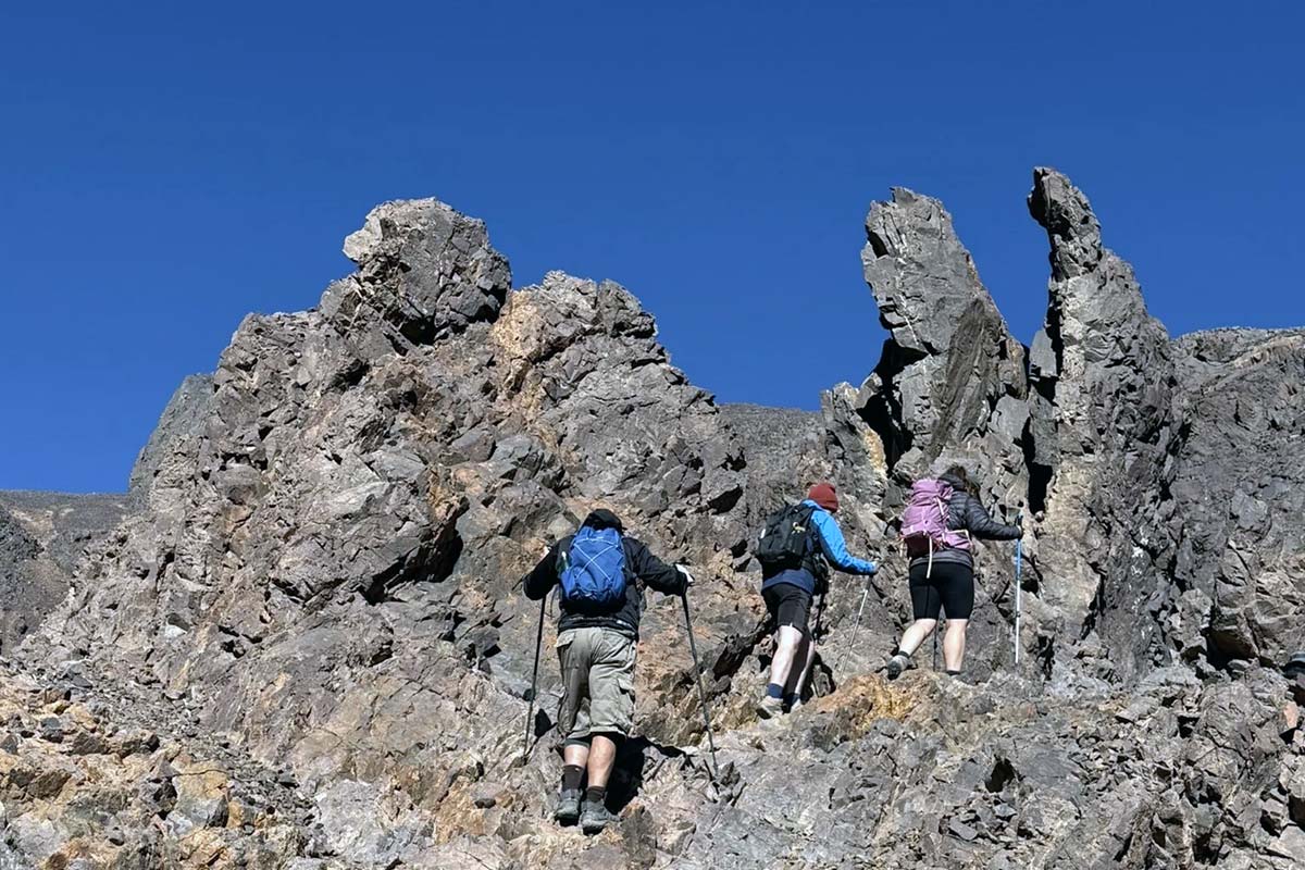
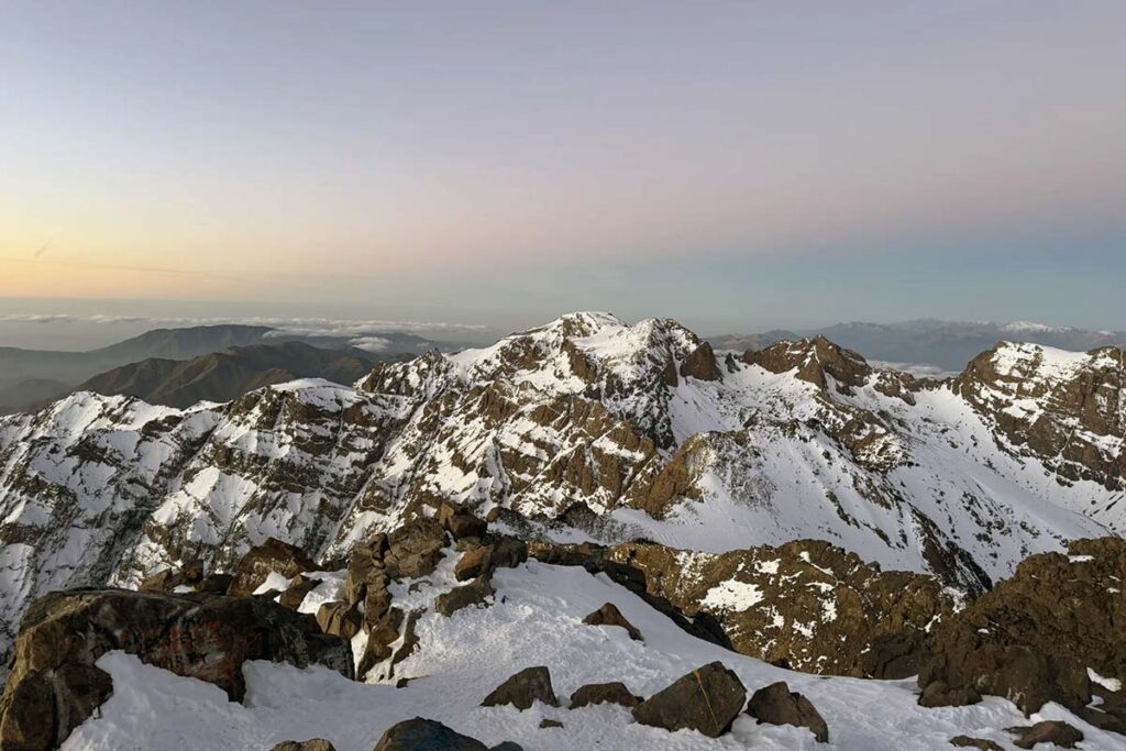
The second-highest mountain in North Africa, climbed from the refuge in a day. The path leaves the cirque westwards up the Ouagane valley, a long bowl of scree and boulders south of the refuges, rising steadily on cairned paths to the col of Tizi n'Ouagane at about 3,750 m, two to two and a half hours above the refuge, with the view opening south over the Anti-Atlas and Jbel Siroua. From the col the broken rocky ridge of Ouanoukrim leads to its two tops in turn: Ras Ouanoukrim (4,083 m), the nearer, and Timesguida (4,089 m), the higher, a short distance beyond — rough walking on shattered rock with no scrambling in summer, and a summit view that puts Toubkal directly across the cirque, with the whole route of tomorrow's climb laid out on its western flank. Lunch is taken on the ridge or back at the col, and the descent follows the same way to the refuge, usually by mid-afternoon, leaving the rest of the day to rest and eat before the second summit morning.

Overnight & Meals: Night 3: mountain refuge at 3,207 m, as before. Meals: breakfast and dinner at the refuge, picnic on the mountain. Water: none above the refuge — carry two to three litres. Bad weather: the Ouanoukrim day becomes a rest day at the refuge; the circuit continues.

Refuge — Ikhibi Sud — Toubkal summit — Sidi Chamharouch — Aroumd — Imlil

Day 4
17–19 km distance +965 m / −2,425 m elevation 8½–10 h walking

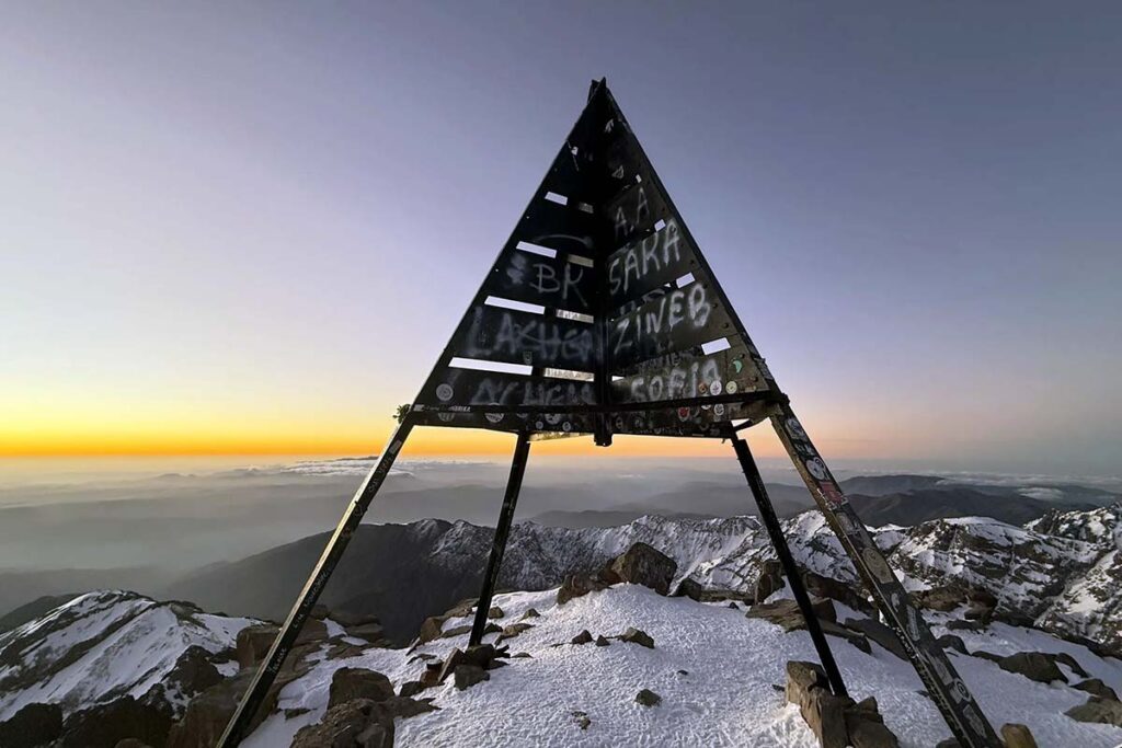
The day begins at around 04:30–05:30 with a head torch. Behind the refuges the path crosses the stream and enters the Ikhibi Sud, the south cwm, a steep bowl of scree and boulders, climbing its right-hand side in loose zigzags. The gradient eases where the cwm opens onto a shoulder, and a rising traverse reaches the col of Tizi n'Toubkal at about 3,940 m. The summit crest leads north-east over broken rock to the iron pyramid at 4,167 m, usually three to four hours after leaving the refuge — this time with two nights at 3,207 m and a 4,000 m summit behind you, so the altitude is felt less than on any other programme. The panorama takes in Ouanoukrim, where you stood yesterday, Tizi Aguelzim on the western rim, the High Atlas ridge, the Anti-Atlas and Jbel Siroua to the south and the Haouz plain to the north. The descent to the refuge takes about two hours on loose scree; after a second breakfast the long walk down the Mizane valley through Sidi Chamharouch and Aroumd to Imlil takes three to four hours more, where your driver waits.

Overnight & Meals: Meals: pre-dawn breakfast and a second breakfast at the refuge, packed lunch on the descent. Back in Marrakech: around 5–6 pm.
AAAWgmp1bWIAAAAeanVtZGMycGEAEQAQgAAAqgA4m3EDYzJwYQAAABZcanVtYgAAAEdqdW1kYzJtYQARABCAAACqADibcQN1cm46YzJwYTpiNWFiMTFhNS1jZTkwLTQ5ODgtOWMwNy0zN2FlOGZjMWVmY2YAAAADl2p1bWIAAAApanVtZGMyYXMAEQAQgAAAqgA4m3EDYzJwYS5hc3NlcnRpb25zAAAAALxqdW1iAAAARGp1bWRjYm9yABEAEIAAAKoAOJtxE2MycGEuaW5ncmVkaWVudC52MwAAAAAYYzJzaMcYmgVnYvxzMJehQM7DBhcAAABwY2JvcqNpZGM6Zm9ybWF0bWltYWdlL3N2Zyt4bWxqaW5zdGFuY2VJRHgseG1wOmlpZDo3MWMzNzIxYi03M2NkLTRiNmUtYWU0Yi05MGEyZmZlODM3NDRscmVsYXRpb25zaGlwaHBhcmVudE9mAAAB4mp1bWIAAABBanVtZGNib3IAEQAQgAAAqgA4m3ETYzJwYS5hY3Rpb25zLnYyAAAAABhjMnNooktt+k7LGyxfZhqdbN76JQAAAZljYm9yomdhY3Rpb25zgqJmYWN0aW9ua2MycGEub3BlbmVkanBhcmFtZXRlcnOha2luZ3JlZGllbnRzgaJjdXJseC1zZWxmI2p1bWJmPWMycGEuYXNzZXJ0aW9ucy9jMnBhLmluZ3JlZGllbnQudjNkaGFzaFggbQNgCJ7wA5zcXYZGaIvJHZh/3JWVFew3ezuoprZPyGakZmFjdGlvbngdY29tLmFudGhyb3BpYy5jbGF1ZGUucHJvdmlkZWRqcGFyYW1ldGVyc6F4H2NvbS5hbnRocm9waWMub3JpZ2luLWNvbmZpZGVuY2VndW5rbm93bmtkZXNjcmlwdGlvbnhmQ2xhdWRlIHByb3ZpZGVkIHRoaXMgZmlsZSBhdCB0aGUgcmVxdWVzdCBvZiBhIHVzZXIgYW5kIG1heSBoYXZlIGNyZWF0ZWQgb3IgbW9kaWZpZWQgdGhlIGZpbGUgY29udGVudHMubXNvZnR3YXJlQWdlbnShZG5hbWVmQ2xhdWRlcmFsbEFjdGlvbnNJbmNsdWRlZPUAAADIanVtYgAAAEBqdW1kY2JvcgARABCAAACqADibcRNjMnBhLmhhc2guZGF0YQAAAAAYYzJzaHoRlpuQvCDa9g2Z/SZCmMAAAACAY2JvcqVjYWxnZnNoYTI1NmNwYWRNAAAAAAAAAAAAAAAAAGRoYXNoWCD6jEFRE4TkiKKVI8yrqfO0k0tRuXqR7EcoDc1CkbJivmRuYW1lbmp1bWJmIG1hbmlmZXN0amV4Y2x1c2lvbnOBomVzdGFydBjSZmxlbmd0aBkeBAAAAj5qdW1iAAAAJ2p1bWRjMmNsABEAEIAAAKoAOJtxA2MycGEuY2xhaW0udjIAAAACD2Nib3KlY2FsZ2ZzaGEyNTZpc2lnbmF0dXJleE1zZWxmI2p1bWJmPS9jMnBhL3VybjpjMnBhOmI1YWIxMWE1LWNlOTAtNDk4OC05YzA3LTM3YWU4ZmMxZWZjZi9jMnBhLnNpZ25hdHVyZWppbnN0YW5jZUlEeCx4bXA6aWlkOjRhNTgyMmViLTZiYmUtNGYzOC1hMjkxLTA2MTY0NDA5NTAxN3JjcmVhdGVkX2Fzc2VydGlvbnODomN1cmx4LXNlbGYjanVtYmY9YzJwYS5hc3NlcnRpb25zL2MycGEuaW5ncmVkaWVudC52M2RoYXNoWCBtA2AInvADnNxdhkZoi8kdmH/clZUV7Dd7O6imtk/IZqJjdXJseCpzZWxmI2p1bWJmPWMycGEuYXNzZXJ0aW9ucy9jMnBhLmFjdGlvbnMudjJkaGFzaFgg5OnBZGEoQchNfUW35T1YoZXqj/PaIp2m/wEvkupBpcSiY3VybHgpc2VsZiNqdW1iZj1jMnBhLmFzc2VydGlvbnMvYzJwYS5oYXNoLmRhdGFkaGFzaFgggm5jfMGV4GtVf8k1x1H1cQA2lq3EK06gJAb3jVyLCx90Y2xhaW1fZ2VuZXJhdG9yX2luZm+jZG5hbWVvQW50aHJvcGljIEZpbGVzZ3ZlcnNpb25lMS4wLjBrc3BlY1ZlcnNpb25lMi40LjAAABA4anVtYgAAAChqdW1kYzJjcwARABCAAACqADibcQNjMnBhLnNpZ25hdHVyZQAAABAIY2JvctKEWQISogEmGCFZAgowggIGMIIBjaADAgECAhRA5aAK7sI50L64g/oGQgU9Z1UTADAKBggqhkjOPQQDAzBJMRcwFQYDVQQKEw5BbnRocm9waWMsIFBCQzEuMCwGA1UEAxMlQW50aHJvcGljIENvbnRlbnQgQ3JlZGVudGlhbHMgUm9vdCBDQTAeFw0yNjA4MDcxODQzNTZaFw0yODA4MDYxOTQzNTZaMEQxFzAVBgNVBAoTDkFudGhyb3BpYywgUEJDMSkwJwYDVQQDEyBBbnRocm9waWMgQ2xhdWRlIENvbnRlbnQgU2lnbmluZzBZMBMGByqGSM49AgEGCCqGSM49AwEHA0IABJh6CmvLUBgFFNU0vUKlOVtE6djd17L5SuwX0LemFisBM3dkd/3cyjxFA3Qo5S46fX0/ihY0VZ7mfb9KF703t5OjWDBWMA4GA1UdDwEB/wQEAwIHgDAVBgNVHSUEDjAMBgorBgEEAYPoXgIBMAwGA1UdEwEB/wQCMAAwHwYDVR0jBBgwFoAUzlHiBIFOZFsj+OPEz5o+nMHXXMIwCgYIKoZIzj0EAwMDZwAwZAIwMXMdFJ4BetLLVY7ORuE9noqbbAZOZn/aArXyTwFAZfKrPzxF2vPoJNf1+UCdg1XGAjBwX1zd9WGqYkqmL5SFqw1QySjr1zJfpJM9+1rdDwSPLMOPOjKuiXjoU/pUUeG9RwmhY3BhZFkNngAAAAAAAAAAAAAAAAAAAAAAAAAAAAAAAAAAAAAAAAAAAAAAAAAAAAAAAAAAAAAAAAAAAAAAAAAAAAAAAAAAAAAAAAAAAAAAAAAAAAAAAAAAAAAAAAAAAAAAAAAAAAAAAAAAAAAAAAAAAAAAAAAAAAAAAAAAAAAAAAAAAAAAAAAAAAAAAAAAAAAAAAAAAAAAAAAAAAAAAAAAAAAAAAAAAAAAAAAAAAAAAAAAAAAAAAAAAAAAAAAAAAAAAAAAAAAAAAAAAAAAAAAAAAAAAAAAAAAAAAAAAAAAAAAAAAAAAAAAAAAAAAAAAAAAAAAAAAAAAAAAAAAAAAAAAAAAAAAAAAAAAAAAAAAAAAAAAAAAAAAAAAAAAAAAAAAAAAAAAAAAAAAAAAAAAAAAAAAAAAAAAAAAAAAAAAAAAAAAAAAAAAAAAAAAAAAAAAAAAAAAAAAAAAAAAAAAAAAAAAAAAAAAAAAAAAAAAAAAAAAAAAAAAAAAAAAAAAAAAAAAAAAAAAAAAAAAAAAAAAAAAAAAAAAAAAAAAAAAAAAAAAAAAAAAAAAAAAAAAAAAAAAAAAAAAAAAAAAAAAAAAAAAAAAAAAAAAAAAAAAAAAAAAAAAAAAAAAAAAAAAAAAAAAAAAAAAAAAAAAAAAAAAAAAAAAAAAAAAAAAAAAAAAAAAAAAAAAAAAAAAAAAAAAAAAAAAAAAAAAAAAAAAAAAAAAAAAAAAAAAAAAAAAAAAAAAAAAAAAAAAAAAAAAAAAAAAAAAAAAAAAAAAAAAAAAAAAAAAAAAAAAAAAAAAAAAAAAAAAAAAAAAAAAAAAAAAAAAAAAAAAAAAAAAAAAAAAAAAAAAAAAAAAAAAAAAAAAAAAAAAAAAAAAAAAAAAAAAAAAAAAAAAAAAAAAAAAAAAAAAAAAAAAAAAAAAAAAAAAAAAAAAAAAAAAAAAAAAAAAAAAAAAAAAAAAAAAAAAAAAAAAAAAAAAAAAAAAAAAAAAAAAAAAAAAAAAAAAAAAAAAAAAAAAAAAAAAAAAAAAAAAAAAAAAAAAAAAAAAAAAAAAAAAAAAAAAAAAAAAAAAAAAAAAAAAAAAAAAAAAAAAAAAAAAAAAAAAAAAAAAAAAAAAAAAAAAAAAAAAAAAAAAAAAAAAAAAAAAAAAAAAAAAAAAAAAAAAAAAAAAAAAAAAAAAAAAAAAAAAAAAAAAAAAAAAAAAAAAAAAAAAAAAAAAAAAAAAAAAAAAAAAAAAAAAAAAAAAAAAAAAAAAAAAAAAAAAAAAAAAAAAAAAAAAAAAAAAAAAAAAAAAAAAAAAAAAAAAAAAAAAAAAAAAAAAAAAAAAAAAAAAAAAAAAAAAAAAAAAAAAAAAAAAAAAAAAAAAAAAAAAAAAAAAAAAAAAAAAAAAAAAAAAAAAAAAAAAAAAAAAAAAAAAAAAAAAAAAAAAAAAAAAAAAAAAAAAAAAAAAAAAAAAAAAAAAAAAAAAAAAAAAAAAAAAAAAAAAAAAAAAAAAAAAAAAAAAAAAAAAAAAAAAAAAAAAAAAAAAAAAAAAAAAAAAAAAAAAAAAAAAAAAAAAAAAAAAAAAAAAAAAAAAAAAAAAAAAAAAAAAAAAAAAAAAAAAAAAAAAAAAAAAAAAAAAAAAAAAAAAAAAAAAAAAAAAAAAAAAAAAAAAAAAAAAAAAAAAAAAAAAAAAAAAAAAAAAAAAAAAAAAAAAAAAAAAAAAAAAAAAAAAAAAAAAAAAAAAAAAAAAAAAAAAAAAAAAAAAAAAAAAAAAAAAAAAAAAAAAAAAAAAAAAAAAAAAAAAAAAAAAAAAAAAAAAAAAAAAAAAAAAAAAAAAAAAAAAAAAAAAAAAAAAAAAAAAAAAAAAAAAAAAAAAAAAAAAAAAAAAAAAAAAAAAAAAAAAAAAAAAAAAAAAAAAAAAAAAAAAAAAAAAAAAAAAAAAAAAAAAAAAAAAAAAAAAAAAAAAAAAAAAAAAAAAAAAAAAAAAAAAAAAAAAAAAAAAAAAAAAAAAAAAAAAAAAAAAAAAAAAAAAAAAAAAAAAAAAAAAAAAAAAAAAAAAAAAAAAAAAAAAAAAAAAAAAAAAAAAAAAAAAAAAAAAAAAAAAAAAAAAAAAAAAAAAAAAAAAAAAAAAAAAAAAAAAAAAAAAAAAAAAAAAAAAAAAAAAAAAAAAAAAAAAAAAAAAAAAAAAAAAAAAAAAAAAAAAAAAAAAAAAAAAAAAAAAAAAAAAAAAAAAAAAAAAAAAAAAAAAAAAAAAAAAAAAAAAAAAAAAAAAAAAAAAAAAAAAAAAAAAAAAAAAAAAAAAAAAAAAAAAAAAAAAAAAAAAAAAAAAAAAAAAAAAAAAAAAAAAAAAAAAAAAAAAAAAAAAAAAAAAAAAAAAAAAAAAAAAAAAAAAAAAAAAAAAAAAAAAAAAAAAAAAAAAAAAAAAAAAAAAAAAAAAAAAAAAAAAAAAAAAAAAAAAAAAAAAAAAAAAAAAAAAAAAAAAAAAAAAAAAAAAAAAAAAAAAAAAAAAAAAAAAAAAAAAAAAAAAAAAAAAAAAAAAAAAAAAAAAAAAAAAAAAAAAAAAAAAAAAAAAAAAAAAAAAAAAAAAAAAAAAAAAAAAAAAAAAAAAAAAAAAAAAAAAAAAAAAAAAAAAAAAAAAAAAAAAAAAAAAAAAAAAAAAAAAAAAAAAAAAAAAAAAAAAAAAAAAAAAAAAAAAAAAAAAAAAAAAAAAAAAAAAAAAAAAAAAAAAAAAAAAAAAAAAAAAAAAAAAAAAAAAAAAAAAAAAAAAAAAAAAAAAAAAAAAAAAAAAAAAAAAAAAAAAAAAAAAAAAAAAAAAAAAAAAAAAAAAAAAAAAAAAAAAAAAAAAAAAAAAAAAAAAAAAAAAAAAAAAAAAAAAAAAAAAAAAAAAAAAAAAAAAAAAAAAAAAAAAAAAAAAAAAAAAAAAAAAAAAAAAAAAAAAAAAAAAAAAAAAAAAAAAAAAAAAAAAAAAAAAAAAAAAAAAAAAAAAAAAAAAAAAAAAAAAAAAAAAAAAAAAAAAAAAAAAAAAAAAAAAAAAAAAAAAAAAAAAAAAAAAAAAAAAAAAAAAAAAAAAAAAAAAAAAAAAAAAAAAAAAAAAAAAAAAAAAAAAAAAAAAAAAAAAAAAAAAAAAAAAAAAAAAAAAAAAAAAAAAAAAAAAAAAAAAAAAAAAAAAAAAAAAAAAAAAAAAAAAAAAAAAAAAAAAAAAAAAAAAAAAAAAAAAAAAAAAAAAAAAAAAAAAAAAAAAAAAAAAAAAAAAAAAAAAAAAAAAAAAAAAAAAAAAAAAAAAAAAAAAAAAAAAAAAAAAAAAAAAAAAAAAAAAAAAAAAAAAAAAAAAAAAAAAAAAAAAAAAAAAAAAAAAAAAAAAAAAAAAAAAAAAAAAAAAAAAAAAAAAAAAAAAAAAAAAAAAAAAAAAAAAAAAAAAAAAAAAAAAAAAAAAAAAAAAAAAAAAAAAAAAAAAAAAAAAAAAAAAAAAAAAAAAAAAAAAAAAAAAAAAAAAAAAAAAAAAAAAAAAAAAAAAAAAAAAAAAAAAAAAAAAAAAAAAAAAAAAAAAAAAAAAAAAAAAAAAAAAAAAAAAAAAAAAAAAAAAAAAAAAAAAAAAAAAAAAAAAAAAAAAAAAAAAAAAAAAAAAAAAAAAAAAAAAAAAAAAAAAAAAAAAAAAAAAAAAAAAAAAAAAAAAAAAAAAAAAAAAAAAAAAAAAAAAAAAAAAAAAAAAAAAAAAAAAAAAAAAAAAAAAAAAAAAAAAAAAAAAAAAAAAAAAAAAAAAAAAAAAAAAAAAAAAAAAAAAAAAAAAAAAAAAAAAAAAAAAAAAAAAAAAAAAAAAAAAAAAAAAAAAAAAAAAAAAAAAAAAAAAAAAAAAAAAAAAAAAAAAAAAAAAAAAAAAAAAAAAAAAAAAAAAAAAAAAAAAAAAAAAAAAAAAAAAAAAAAAAAAAAAAAAAAAAAAAAAAAAAAAAAAAAAAAAAAAAAAAAAAAAAAAAAAAAAAAAAAAAAAAAAAAAAAAAAAAAAAAAAAAAAAAAAAAAAAAAAAAAAAAAAAAAAAAAAAAAAAAAAAAAAAAAAAAAAAAAAAAAAAAAAAAAAAAAAAAAAAAAAAAAAAAAAAAAAAAAAAAAAAAAAAAAAAAAAAAAAAAAAAAAAAAAAAAAAAAAAAAAAAAAAAAAAAAAAAAAAAAAAAAAAAAAAAAAAAAAAAAAAAAAAAAAAAAAAAAAAAAAAAAAAAAAAAAAAAAAAAAAAAAAAAAAAAAAAAAAAAAAAAAAAAAAAAAAAAAAAAAAAAAAAAAAAAAAAAAAAAAAAAAAAAAAAAAAAAAAAAAAAAAAAAAAAAAAAAAAAAAAAAAAAAAAAAAAAAAAAAAAAAAAAAAAAAAAAAAAAAAAAAAAAAAAAAAAAAAAAAAAAAAAAAAAAAAAAAAAAAAAAAAAAAAAAAAAAAAAAAAAAAAAAAAAAAAAAAAAAAAAAAAAAAAAAAAAAAAAAAAAAAAAAAAAAAAAAAAAAAAAAAAAAAAAAAAAAAAAAAAAAAAAAAAAAAAAAAAAAAAAAAAAAAAAAAAAAAAAAAAAAAAAAAAAAAAAAAAAAAAAAAAAAAAAAAAAAAAAAAAAAAAAAAAAAAAAAAAAAAAAAAAAAAAAAAAAAAAAAAAAAAAAAAAAAAAAAAAAAAAAAAAAAAAAAAAAAAAAAAAAAAAAAAAAAAAPZYQH18Oof6Pb1dDSbco8k0USkDhmjKcU478Iaf3mMYaUXQjwwf1K3fMiIqVUjpkPjGn/EJgjO0LSE5g9059NA1NUU= 31.04°N 31.06°N 31.08°N 31.10°N 31.12°N 31.14°N 7.98°W 7.96°W 7.94°W 7.92°W 7.90°W Imlil — start & finish Imlil — start & finish 1,740 m 1,740 m Mzik Mzik 1,850 m 1,850 m Tizi Mzik Tizi Mzik 2,489 m 2,489 m 1 Azib Tamsoult — night 1 Azib Tamsoult — night 1 2,250 m 2,250 m Ighouliden waterfalls Ighouliden waterfalls 2,400 m 2,400 m Tizi Aguelzim Tizi Aguelzim 3,560 m 3,560 m 2 Toubkal refuges — night 2 Toubkal refuges — night 2 3,207 m 3,207 m Tizi n'Ouagane Tizi n'Ouagane 3,750 m 3,750 m Ras Ouanoukrim Ras Ouanoukrim 4,083 m 4,083 m Timesguida Timesguida 4,089 m 4,089 m 3 Toubkal refuges — night 3 Toubkal refuges — night 3 3,207 m 3,207 m Tizi n'Toubkal Tizi n'Toubkal 3,940 m 3,940 m Jbel Toubkal Jbel Toubkal 4,167 m 4,167 m Sidi Chamharouch Sidi Chamharouch 2,350 m 2,350 m Aroumd Aroumd 1,900 m 1,900 m Day 1 Day 2 Day 3 Day 4 IMLIL TREK · ROUTE MAP 18 4-Day Toubkal and Ouanoukrim Circuit via the Azzaden Valley Loop · 43–50 km · +4,035 m · 4 days · north up N 0 2 km Start / finish Overnight stop (numbered) Pass Summit / highest point Waypoint Walking route (direction arrows) Schematic map, north up. Waypoints are plotted at their map coordinates; the line between them is smoothed and does not show every bend of the path. Verify against the GPX track before publication. © 2026 Imlil Trek by Extra Mile. Click to enlarge
Route map: 4-Day Toubkal and Ouanoukrim Circuit. The Toubkal day is GPS-verified; the Aguelzim and Ouanoukrim stages are estimated until recorded.
Technical specifications

The numbers behind the day

Figures are marked by how they were obtained: GPS-verified from a recorded track, estimated from measured segments, or still to be verified on the ground.

 Day 1 — to TamsoultDay 2 — Tizi AguelzimDay 3 — OuanoukrimDay 4 — Toubkal and downWhole trek
Elevation1,740 m → 2,489 m → 2,250 m2,250 m → 3,560 m → 3,207 m3,207 m → 4,089 m → 3,207 m3,207 m → 4,167 m → 1,740 mHighest point 4,167 m
Distance8–9 km Measured10–13 km Estimated8–9 km Estimated17–19 km GPS verified43–50 km
Ascent / descent+820 m / −310 m+1,350 m / −400 m+900 m / −900 m+965 m / −2,425 m+4,035 m / −4,035 m
Walking time4½–5½ h with breaks7–9 h with breaks5½–7 h with breaks8½–10 h with breaks26–31½ h with breaks
DifficultyModerateStrenuousStrenuousStrenuousStrenuous — three strenuous days in a row
TerrainGraded mule track, forest pathRocky path, c. 80 scree zigzags, stony descentScree and boulders to the col, broken rocky ridge to both topsScree cwm, rocky ridge, long valley trackNo scrambling in season; no exposure
OvernightTamsoult pastures — refuge or campMountain refuge, 3,207 mMountain refuge, 3,207 m—3 nights
WaterSpring at Mzik; drinks at the pasturesNone between the falls and the refugeNone above the refugeNone above the refugeMineral water provided
AltitudeSleep 2,250 mCross 3,560 m, sleep 3,207 mSummit 4,089 m, sleep 3,207 mSummit 4,167 mTwo 4,000 m days back to back

Ouanoukrim's two tops are given as Timesguida 4,089 m and Ras Ouanoukrim 4,083 m; Tizi n'Ouagane is c. 3,750 m (3,730–3,780 m by source). The Ouanoukrim round from the refuge is estimated at 8–9 km; the Toubkal day uses the recorded 7.1 km summit loop and 12.3 km descent.

The price is the price

What's included

Included in every booking

  • Licensed mountain guide English/French speaking, from the Imlil valley
  • Private return transfer Marrakech ↔ Imlil air-conditioned vehicle, pickup and drop-off at your Marrakech accommodation
  • One night at the Tamsoult pastures mountain refuge or camp, selected by Imlil Trek
  • Two nights at the mountain refuge dormitory-style, 3,207 m, selected by Imlil Trek
  • Full-board meals on trek lunch Day 1 through lunch Day 4
  • Mineral water throughout
  • Luggage carried by mule between the overnight stops including over Tizi Aguelzim in season
  • Safety monitoring and mountain logistics

Not included

  • Flights to Marrakech
  • Travel insurance required — cover for trekking to 4,200 m plus emergency evacuation
  • Personal trekking gear boots, layers, daypack and any equipment rental
  • Drinks other than the mineral water provided, and snacks
  • Tips for the guide and muleteer
  • Marrakech hotel nights and personal expenses

Available on request (extra):

  • Trekking equipment rental crampons, ice axe, boots, poles
  • Private room at the refuge subject to availability
  • Extra night in Imlil before or after the trek
  • Porter for personal luggage
  • Vegetarian, vegan & special-diet meals tell us in advance
  • Airport transfer in Marrakech
Private trek — priced by group size

Prices per person

Every departure is 100% private to your group. Per-person prices decrease as your group size shares fixed guide, cook, and transfer costs.

Your group
Per person
Notes
1 person Private solo trek
€690
Private solo trek
2 people Most-booked size
€520
Most-booked size
3 people
€440
4 people
€390
5 people
€360
6 people
€340
7–9 people
€325
10–13 people
€310
14–17 people Published floor price
€300
Published floor price

Prices are for the 2026 season and can rise in winter and snow periods, when porters, crampons, ice axes and extra guides are needed for safety. Full breakdown of where the money goes: Morocco trekking costs, explained.

Mountain briefing

Prepare for the trek

Fitness and experience needed
The hardest four-day programme we run. After a moderate first day, days two, three and four are consecutive strenuous days: 1,350 m of ascent to a 3,560 m col on scree, a 900 m round to two 4,000 m summits on broken rock, and a pre-dawn climb to 4,167 m followed by 2,400 m of descent — seven to ten hours on each. Nothing is technical in season and there is no exposure, but the altitude profile is severe: the group sleeps at 2,250 m, crosses 3,560 m the next day and then spends two nights at 3,207 m with a 4,000 m summit between them. Very good fitness, previous multi-day mountain trekking and comfort on scree and broken rock are required; anyone unsure of their tolerance for altitude should choose the refuge-based four-day ascent, which climbs the same two summits with a gentler lead-in. Altitude explained: altitude sickness on Toubkal.
What to pack (Seasonal checklist)
  • Broken-in trekking boots with a stiff sole loose scree on the summit day
  • Daypack 30–35 L with a rain cover
  • Three layers: wicking base layer, fleece or light down, waterproof and windproof shell
  • Insulated jacket, warm hat and gloves for the pre-dawn summit start
  • Head torch with spare batteries
  • Category 3–4 sunglasses, SPF 50, lip balm
  • Two to three litres of water capacity
  • Trekking poles strongly recommended for the 2,400 m descent
  • Sleeping bag liner and a 3-season sleeping bag refuge blankets are provided but nights are cold
  • Personal first-aid kit, blister care, altitude medication if prescribed
  • Snacks for the summit morning, passport or ID, cash in dirhams
  • Everything in the May–Oct list
  • B1-rated boots, gaiters, a spare pair of gloves and a balaclava
  • Crampons and an ice axe rented through us and fitted in Imlil
  • A warmer sleeping bag refuge nights are well below freezing
Safety and guide responsibility
The whole route lies inside the Toubkal National Park (created 1942); carry your passport for the checkpoints on the Mizane side. A licensed guide has been compulsory in the Toubkal National Park since 2019; yours is licensed and local, carries first aid and adjusts the day to conditions. Pickup at your Marrakech accommodation in the morning, the drive via Asni to Imlil, and the same vehicle waiting in Imlil on day four for the return around 5–6 pm. Altitude sickness is the main risk across three consecutive high days; afternoon storms can build on the cols in summer; all three descents are on loose scree or broken rock. The guide decides each morning whether the col or the summit is attempted, and the Ouanoukrim day becomes a rest day at the refuge when conditions require it. Travel insurance must cover trekking to 4,200 m plus emergency evacuation. Travel insurance covering walking to 4,200 m plus emergency evacuation is recommended. Licensed and insured operator, 16D/19. More in our trekking safety guide.
Three high nights
The first night is at the Tamsoult pastures at 2,250 m, where a small mountain refuge and a camping area serve trekkers beneath the Tazaghart cliffs — dormitory-style sleeping or tents, blankets, hot meals, cold starry nights. The second and third are at the head of the Mizane valley at 3,207 m, in a mountain refuge beneath the north face of Toubkal: dormitory rooms, blankets, a communal dining room with hot meals and shared washrooms. Imlil Trek selects the best available accommodation at each stop, prioritising comfort, cleanliness, hospitality and authenticity; hot showers, heating and electricity vary and cannot be guaranteed, and all three nights are cold in every season. Mobile signal: little or none at Tamsoult and on the Aguelzim path, patchy at the refuges.
Why Ouanoukrim first
Ouanoukrim is the second-highest mountain in North Africa, a long twin-topped crest on the south-west rim of the cirque that few Toubkal visitors climb. Taking it on the third day, from the refuge, does two things: it gives a second 4,000 m summit with a view of Toubkal's whole western flank, and it serves as the best acclimatisation day the massif offers before the Toubkal morning. The circuit itself — in by the Azzaden and Tizi Aguelzim, out by the normal route — repeats no ground. Why the valley is worth it: the Azzaden, the scenic route to Toubkal.
Best months for this circuit
June–early October — the season for this route: Tizi Aguelzim and the Ouagane valley free of snow, the summit cwms dry. June and September are the most comfortable; July and August bring the chance of afternoon storms on the high ground, which the early starts avoid.
May and late October — the cols and cwms often carry snow; the circuit depends on conditions, winter equipment and the guide's approval, and the Ouanoukrim day is the first to be dropped.
November–April — not run as a circuit: the two summits are then winter climbs by the normal route only. Month by month: best time to trek the Atlas.
Back down and smiling

Verified trekker reviews

★★★★★
"For hikers who want maximum alpine scenery and summits, this 4-day circuit is unbeatable. Climbing the Azzaden valley, tackling the 80 switchbacks to Tizi Aguelzim, scrambling the twin summits of Ouanoukrim (4,089 m), and standing on Mount Toubkal at dawn—it was non-stop breathtaking adventure. Top-tier mountain guides."
Dominic & Claire Shaw, Leeds, UKTripadvisor • October 2026
★★★★★
"The complete high-altitude circuit. Approaching from Azzaden meant we saw both sides of the massif, avoiding the repetitive out-and-back trail. The Ouanoukrim scramble requires sure-footedness, but guide Youssef made us feel completely secure. Five stars for safety, food, and route design."
Maximilian & Eva Kraus, Munich, GermanyTripadvisor • September 2026
★★★★★
"Tough, strenuous, and utterly rewarding! Having three consecutive days operating above 3,500 m gave us an authentic mountaineering rush without needing technical ropes. The team took fantastic care of all logistics and meals. Highly recommended for fit hikers."
Scott & Megan Taylor, Sydney, AustraliaTripadvisor • June 2026
Asked before this trek

4-Day Toubkal and Ouanoukrim Circuit via the Azzaden Valley questions

How hard is this circuit?
The hardest four-day programme we run: after a moderate first day, three consecutive strenuous days — a 3,560 m col on scree, a 4,000 m summit round on broken rock, then Toubkal at dawn and a 2,400 m descent. Very good fitness and previous multi-day mountain experience are required.
What is Ouanoukrim?
The second-highest mountain in North Africa, a long twin-topped crest on the south-west rim of the Toubkal cirque: Timesguida (4,089 m) and Ras Ouanoukrim (4,083 m). It is climbed from the refuge via Tizi n'Ouagane on day three.
Is climbing Ouanoukrim technical?
Not in season: scree and boulders to the col, then rough walking on broken rock along the ridge, with no scrambling or exposure. Snow outside June–October changes that, and the day is then dropped.
Will I get altitude sickness?
The profile is severe — 2,250 m to a 3,560 m col in a day, then two nights at 3,207 m with a 4,000 m summit between them — so mild symptoms are likely at some point. The Ouanoukrim day also acclimatises you for Toubkal; the guide monitors the group and descends with anyone who develops serious symptoms.
When can this circuit be walked?
June to early October, when Tizi Aguelzim and the Ouagane valley are snow-free. In May and late October the guide decides; in winter the summits are climbed by the normal route only.
What happens if the weather turns on the Ouanoukrim day?
It becomes a rest day at the refuge and the circuit continues with the Toubkal summit the next morning.
Do mules carry our bags over Tizi Aguelzim?
In the snow-free season, yes; you walk with a daypack. The refuge days need only a daypack in any case.
Do I need a guide?
Yes — a licensed mountain guide is compulsory throughout the Toubkal National Park and leads every departure. Your guide is included.
Read before you book

Guides for this route

  • How to prepare for Mount Toubkal — The complete preparation guide for climbing Mount Toubkal (4,167 m) — an 8-week cardio and hill conditioning plan…
  • Altitude sickness on Toubkal — Medical facts on Acute Mountain Sickness (AMS) above 3,000 meters in the High Atlas — recognizing symptoms…
  • The Toubkal refuges explained — Everything you need to know about staying at 3,207 m beneath Mount Toubkal — comparing the historic CAF Refuge Neltner…
  • Atlas Mountains packing list — Comprehensive gear checklist for hiking in the High Atlas — 3-season valley trekking vs 4,000 m Toubkal summit…
From €300per person, all-inclusive
Check dates & Book

Your Atlas Adventure Starts with a Conversation

Tell us your dates, your group size, and what kind of experience you’re looking for. We’ll design a trek that fits — no obligation, no pressure, just mountain expertise.

Direct with Certified local Mountain Guides in Imlil — no middleman, transparent pricing.