Tap a day to trace it. Your certified guide sets the pace and monitors acclimatization throughout.
Imlil — Mzik — Tizi Mzik — Azib Tamsoult
Day 1
8–9 km distance +820 m / −310 m elevation 4½–5½ h walking
Pickup from your Marrakech riad and the 90-minute drive to Imlil (1,740 m), where you meet your guide and muleteer. The trek leaves the village on the track west through the hamlet of Arghen to Mzik, where a spring under walnut trees marks the end of the orchards and the start of the climb. The mule track rises in long, even switchbacks across the open hillside through juniper and scrub, passing the boundary sign of the Toubkal National Park, with the view back over Imlil, Aroumd and the Toubkal massif widening at every turn; after two and a half to three hours it reaches Tizi Mzik (2,489 m), a broad saddle with the Azzaden valley dropping away to the west and the cliffs of the Tazaghart plateau beyond. The afternoon is a descent through juniper forest into the upper Azzaden, losing about 250 m over 3.5 km to the pastures of Azib Tamsoult at 2,250 m — a grassy bowl with stone shepherd shelters and a small mountain refuge beside the stream. Arriving by mid-afternoon leaves time to rest: the next three days are the hard ones.
Overnight & Meals: Night 1: mountain refuge or camp at the Tamsoult pastures (2,250 m), selected by Imlil Trek — dormitory or tents, hot meals, cold nights. Meals: picnic lunch at the pass, dinner at the pastures.
Azib Tamsoult — Ighouliden falls — Tizi Aguelzim — mountain refuge
Day 2
10–13 km distance +1,350 m / −400 m elevation 7–9 h walking
An early start. From the pastures a rocky path climbs the valley for about forty minutes to the Ighouliden waterfalls, where the stream drops in several steps down a rock wall. Above the falls the valley narrows and turns stony, and the path begins the long climb that gives the day its character: a seemingly endless series of zigzags — around eighty of them — up a scree slope to the col of Tizi Aguelzim at 3,560 m. The gradient is steady and the path good, but the altitude is felt increasingly above 3,000 m, and the climb takes four to five hours from the pastures. The col is one of the finest viewpoints in the range: the entire Toubkal cirque opens ahead, the twin refuges visible as specks at the valley head, the summit ridge above them and, across the cirque, the long crest of Ouanoukrim you will climb tomorrow. Lunch is taken at or just below the col. The descent into the Mizane cirque is steep and stony at first, then eases to the refuges at 3,207 m, reached in about two hours.
Overnight & Meals: Night 2: mountain refuge at 3,207 m, selected by Imlil Trek — dormitory-style, blankets, hot dinner. Meals: breakfast at the pastures, picnic at the col, dinner at the refuge. Water: fill every bottle at Tamsoult — nothing until the refuge.
Refuge — Tizi n'Ouagane — Timesguida and Ras Ouanoukrim — refuge
Day 3
8–9 km distance +900 m / −900 m elevation 5½–7 h walking
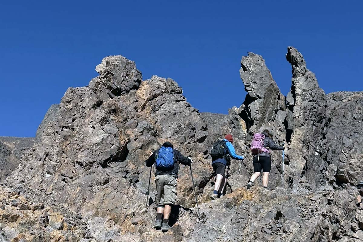
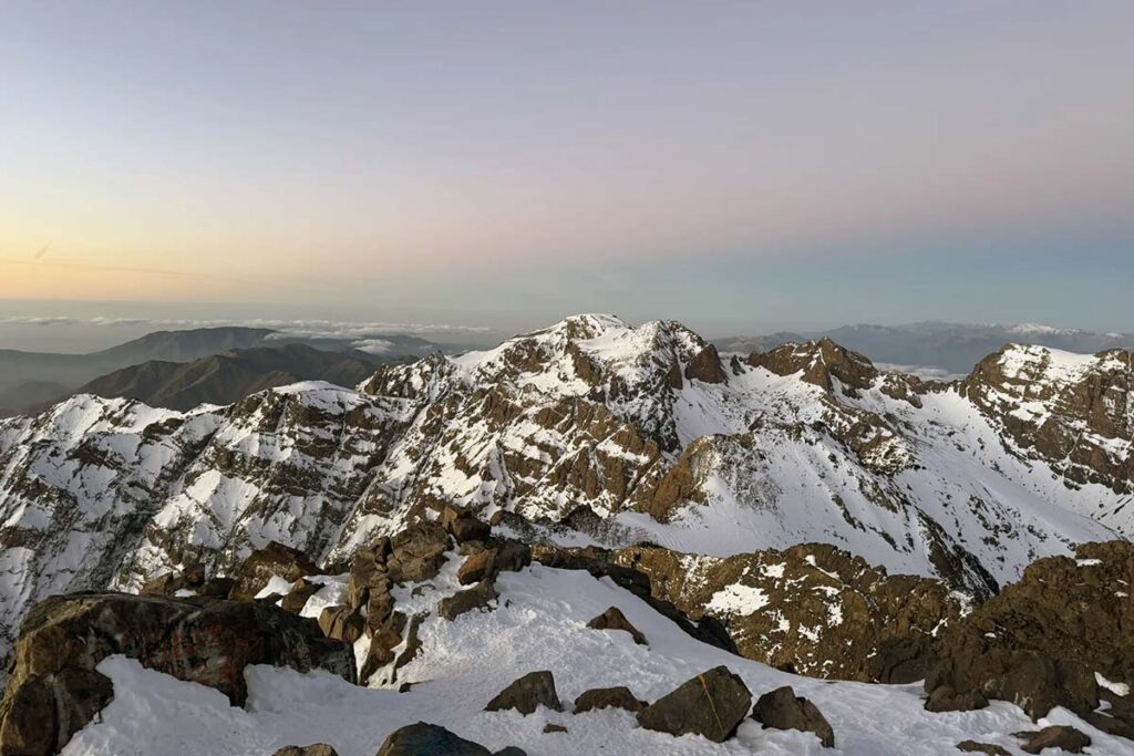
The second-highest mountain in North Africa, climbed from the refuge in a day. The path leaves the cirque westwards up the Ouagane valley, a long bowl of scree and boulders south of the refuges, rising steadily on cairned paths to the col of Tizi n'Ouagane at about 3,750 m, two to two and a half hours above the refuge, with the view opening south over the Anti-Atlas and Jbel Siroua. From the col the broken rocky ridge of Ouanoukrim leads to its two tops in turn: Ras Ouanoukrim (4,083 m), the nearer, and Timesguida (4,089 m), the higher, a short distance beyond — rough walking on shattered rock with no scrambling in summer, and a summit view that puts Toubkal directly across the cirque, with the whole route of tomorrow's climb laid out on its western flank. Lunch is taken on the ridge or back at the col, and the descent follows the same way to the refuge, usually by mid-afternoon, leaving the rest of the day to rest and eat before the second summit morning.
Overnight & Meals: Night 3: mountain refuge at 3,207 m, as before. Meals: breakfast and dinner at the refuge, picnic on the mountain. Water: none above the refuge — carry two to three litres. Bad weather: the Ouanoukrim day becomes a rest day at the refuge; the circuit continues.
Refuge — Ikhibi Sud — Toubkal summit — Sidi Chamharouch — Aroumd — Imlil
Day 4
17–19 km distance +965 m / −2,425 m elevation 8½–10 h walking
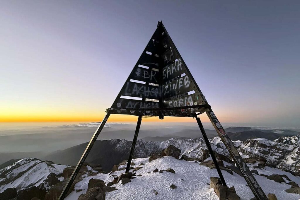
The day begins at around 04:30–05:30 with a head torch. Behind the refuges the path crosses the stream and enters the Ikhibi Sud, the south cwm, a steep bowl of scree and boulders, climbing its right-hand side in loose zigzags. The gradient eases where the cwm opens onto a shoulder, and a rising traverse reaches the col of Tizi n'Toubkal at about 3,940 m. The summit crest leads north-east over broken rock to the iron pyramid at 4,167 m, usually three to four hours after leaving the refuge — this time with two nights at 3,207 m and a 4,000 m summit behind you, so the altitude is felt less than on any other programme. The panorama takes in Ouanoukrim, where you stood yesterday, Tizi Aguelzim on the western rim, the High Atlas ridge, the Anti-Atlas and Jbel Siroua to the south and the Haouz plain to the north. The descent to the refuge takes about two hours on loose scree; after a second breakfast the long walk down the Mizane valley through Sidi Chamharouch and Aroumd to Imlil takes three to four hours more, where your driver waits.
Overnight & Meals: Meals: pre-dawn breakfast and a second breakfast at the refuge, packed lunch on the descent. Back in Marrakech: around 5–6 pm.