Request a quote

5-Day Traverse from Oukaimeden to Aguersioual: Imenane, Mizane and Azzaden

Start high, on the summer plateau of the ski station, and walk south and west through three valleys and over four passes — the highest village in the range, Aroumd under Toubkal, the pastures beneath Tazaghart — with the day's ascent mostly behind you by lunchtime.

5 days4 nights — Ouanskra, Aroumd, Tamsoult, Tiziane
2,930 mSummit / Highest Point
55–56 kmTotal Distance
+2,570 mTotal Ascent (D+/D−)
EasyFitness Grade
May–OctRecommended Season
The 5-Day Traverse from Oukaimeden to Aguersioual starts on the Oukaimeden plateau at 2,620 m and walks south and west through three valleys. Day one crosses Tizi n'Ou Addi (2,928 m) beneath Jbel Angour to Tacheddirt and Ouanskra in the Imenane; day two crosses Tizi n'Tamatert (2,279 m) to Aroumd, facing Toubkal; day three climbs out of the Mizane over Tizi n'Tzikert (2,930 m), the highest point, and drops to the Tamsoult pastures; day four follows the Azzaden down through Tizi Oussem and Aït Aïssa to Tiziane; day five crosses Tizi Oudite (2,219 m) to Matate and the Imlil road at Aguersioual. About 55–56 km with 2,570 m of ascent and 3,510 m of descent — moderate to challenging, no technical ground, a May-to-October route. A licensed mountain guide, transfers at both ends, four nights, full board and mineral water are included, from €420 per person. The downhill-leaning traverse in our Atlas treks range, inside the Toubkal National Park (established 1942).
The route, drawn to scale

Day-by-day mountain route

Tap a day to trace it. Your certified guide sets the pace and monitors acclimatization throughout.

2,000 2,500 3,000 alt m Oukaimeden 2,620 m Tizi n'Ou Addi Tacheddirt Ouanskra — night 1 Tizi n'Tamatert Aroumd — night 2 Tizi n'Tzikert 2,930 m Tamsoult — night 3 Tizi Oussem Tiziane — night 4 Tizi Oudite Matate Aguersioual 1,680 m 2,000 2,500 3,000 Oukaimeden 2,620 m Tizi n'Tzikert 2,930 m Aguersioual 1,680 m

Oukaimeden — Tizi n'Ou Addi — Tacheddirt — Ouanskra

Day 1
11 km distance +350 m / −970 m elevation 4½–5½ h walking

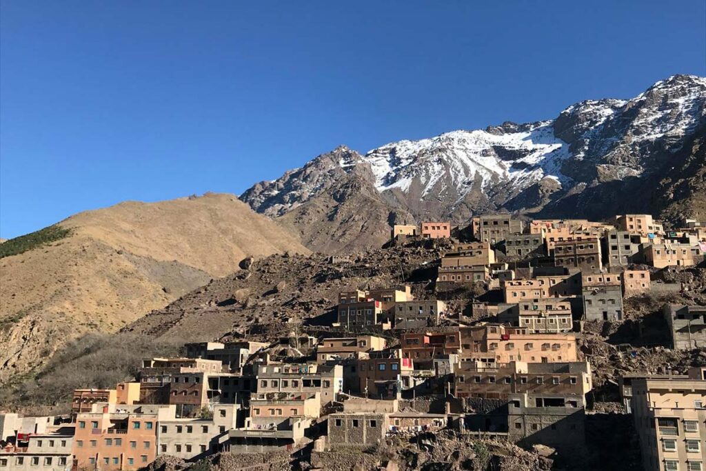
Pickup from your Marrakech riad and a drive of about 1 h 45 up the Ourika valley to Oukaimeden, Morocco's best-known ski station, at 2,620 m — in summer a broad alpine meadow beneath Jbel Oukaimeden (3,263 m) with shepherds' flocks, prehistoric rock carvings and the quiet buildings of the resort, where you meet your guide and muleteers. The walk starts high and climbs only modestly: the mule path leaves the end of the plateau road and rises south to Tizi n'Ou Addi at 2,928 m, the pass beneath the dark north face of Jbel Angour, in little more than an hour, with the Imenane valley and the peaks of Aksoual and Bou Iguenouane opening ahead. A long descent follows, first on stony ground and then through terraces, to Tacheddirt at about 2,300 m, the highest permanent village in the High Atlas, where lunch is taken. The afternoon continues down the Imenane on the level path above the river for about an hour to Ouanskra at about 2,000 m, a village of stacked stone houses facing Tinerhourhine across the water, where the night is spent.

Overnight & Meals: Night 1: traditional mountain guesthouse in Ouanskra (c. 2,000 m), selected by Imlil Trek. Meals: lunch in Tacheddirt, home-cooked dinner. Altitude: the trek starts at 2,620 m — the first morning is taken slowly.

Ouanskra — Tinerhourhine — Tizi n'Tamatert — Tamatert — Aït Souka — Aroumd

Day 2
12 km distance +450 m / −550 m elevation 5–6 h walking

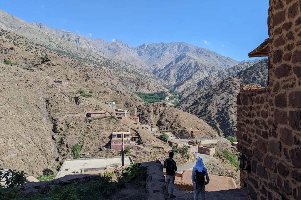
From Ouanskra the path crosses the Assif Imenane to Tinerhourhine and climbs south-west through Aleppo pine and juniper in steady zigzags to Tizi n'Tamatert (2,279 m), the pass that links the Imenane to the Imlil valley, and the natural lunch stop: the Toubkal massif fills the view to the south — the first full sight of the mountain on this trek — and the Imlil valley lies spread out below. The descent follows the mule track through pine and juniper to Tamatert at about 1,810 m, a compact village of earth-built houses, then contours through the walnut terraces of Aït Souka without dropping to Imlil centre, crosses the stream and climbs the stone steps into Aroumd at 1,900 m, the largest village of the Mizane valley, on a rocky spur facing Toubkal. The night is spent in the village, with the north face of the mountain at the head of the valley.

Overnight & Meals: Night 2: traditional mountain guesthouse in Aroumd (1,900 m), selected by Imlil Trek — rooms, a terrace facing the mountain, home-cooked dinner. Meals: breakfast at the guesthouse, picnic lunch at the pass, dinner at the guesthouse. Resupply: shops in Aroumd.

Aroumd — Tizi n'Tzikert — Azib Tamsoult

Day 3
10 km distance +1,050 m / −700 m elevation 5½–6½ h walking

The one challenging day, and the crossing from the Mizane to the Azzaden by the high route. From Aroumd the path climbs north-west on shepherd paths above the terraces, steadily and then steeply, gaining 1,030 m in about 6 km to the col of Tizi n'Tzikert at 2,930 m, the highest point of the trek, reached in three and a half to four hours with the north face of Toubkal growing across the valley behind you at every rest. The col sits on the ridge between the two valleys, with the upper Azzaden, the Tamsoult bowl and the Tazaghart cliffs opening ahead; lunch is taken here. Walkers with energy in hand can add the short rocky ridge north to the summit of Adrar El Hadj (3,134 m), about forty minutes each way, for the finest view of Toubkal on any of our valley treks. The descent is steep and loose at first, dropping 680 m in about 3 km to the summer pastures of Azib Tamsoult at 2,250 m, a grassy bowl with shepherds' stone shelters and a small mountain refuge beside the stream, where the night is spent.

Overnight & Meals: Night 3: mountain refuge or camp at the Tamsoult pastures (2,250 m), selected by Imlil Trek — dormitory or tents, hot meals, a cold starry night. Meals: breakfast at the guesthouse, picnic lunch at the col, dinner at the pastures. Water: none between Aroumd and Tamsoult — carry two litres. Snow on the col: the day becomes Imlil to Tamsoult over Tizi Mzik.

Azib Tamsoult — Tizi Oussem — Aït Aïssa — Tiziane

Day 4
12 km distance +100 m / −650 m elevation 4½–5½ h walking

An easy day down the valley. The morning can start with the Ighouliden waterfalls, a forty-minute side trip up the valley from the pastures to the highest cascades in the massif, at their fullest in spring. The route then descends through the Tamsoult gorges, crossing the stream on stepping stones, through juniper to Tizi Oussem (1,850 m), the last inhabited village in the valley, its red clay houses stacked above the river — mint tea in a village house is customary — and continues on the mule track through fields of barley and maize and groves of walnut to Aït Aïssa (Id Aïssa) at about 1,800 m and on down the valley path for 30–45 minutes to Tiziane, a terraced village at about 1,700 m, where the fourth night is spent.

Overnight & Meals: Night 4: traditional mountain guesthouse in Tiziane (c. 1,700 m), selected by Imlil Trek — simple rooms, blankets, home-cooked dinner. Meals: breakfast at the pastures, picnic lunch near Tizi Oussem, dinner at the guesthouse. Optional: the Ighouliden waterfalls before leaving the pastures.

Tiziane — Aït Aïssa — Tizi Oudite — Matate — Aguersioual

Day 5
10–11 km distance +620 m / −640 m elevation 5–6 h walking

The last day leaves the Azzaden by the back door. From Tiziane the path climbs back through Aït Aïssa and up through terraces and juniper to the cairns on Tizi Oudite (2,219 m), with a last look over the valley and the high plateau of Tazaghart, then crosses the open plateau of thuriferous junipers below the col — rough and occasionally faint, which is why a local guide matters here — and descends more steeply into the narrow Matat side valley, through open slopes and then walnut groves and terraced fields, to the hamlet of Matate, the usual picnic stop by the stream. An easy hour on the valley path brings you to Aguersioual, a village on the Asni–Imlil road at about 1,680 m, where the traverse ends and your driver waits.

Overnight & Meals: Meals: breakfast at the guesthouse, picnic lunch at Matate. Back in Marrakech: late afternoon.
AAAWgmp1bWIAAAAeanVtZGMycGEAEQAQgAAAqgA4m3EDYzJwYQAAABZcanVtYgAAAEdqdW1kYzJtYQARABCAAACqADibcQN1cm46YzJwYTpkN2IwNjgyZS05NDNlLTRjNTYtYjI1Yy1hYWZkOTRiNDFjYmQAAAADl2p1bWIAAAApanVtZGMyYXMAEQAQgAAAqgA4m3EDYzJwYS5hc3NlcnRpb25zAAAAALxqdW1iAAAARGp1bWRjYm9yABEAEIAAAKoAOJtxE2MycGEuaW5ncmVkaWVudC52MwAAAAAYYzJzaP4ipljZ0ggRWNoZnCjGu1MAAABwY2JvcqNpZGM6Zm9ybWF0bWltYWdlL3N2Zyt4bWxqaW5zdGFuY2VJRHgseG1wOmlpZDo3MDkxMTMzOS0xZjJmLTQxNGItYTA4ZC0xNjMzMjk5NWMzMTNscmVsYXRpb25zaGlwaHBhcmVudE9mAAAB4mp1bWIAAABBanVtZGNib3IAEQAQgAAAqgA4m3ETYzJwYS5hY3Rpb25zLnYyAAAAABhjMnNop7bWNHt8QEH50o+4v81y+gAAAZljYm9yomdhY3Rpb25zgqJmYWN0aW9ua2MycGEub3BlbmVkanBhcmFtZXRlcnOha2luZ3JlZGllbnRzgaJjdXJseC1zZWxmI2p1bWJmPWMycGEuYXNzZXJ0aW9ucy9jMnBhLmluZ3JlZGllbnQudjNkaGFzaFggYwzj+9PylV9iEdGKz9mPOMDEs0j6+kVVOOU99MlU9gekZmFjdGlvbngdY29tLmFudGhyb3BpYy5jbGF1ZGUucHJvdmlkZWRqcGFyYW1ldGVyc6F4H2NvbS5hbnRocm9waWMub3JpZ2luLWNvbmZpZGVuY2VndW5rbm93bmtkZXNjcmlwdGlvbnhmQ2xhdWRlIHByb3ZpZGVkIHRoaXMgZmlsZSBhdCB0aGUgcmVxdWVzdCBvZiBhIHVzZXIgYW5kIG1heSBoYXZlIGNyZWF0ZWQgb3IgbW9kaWZpZWQgdGhlIGZpbGUgY29udGVudHMubXNvZnR3YXJlQWdlbnShZG5hbWVmQ2xhdWRlcmFsbEFjdGlvbnNJbmNsdWRlZPUAAADIanVtYgAAAEBqdW1kY2JvcgARABCAAACqADibcRNjMnBhLmhhc2guZGF0YQAAAAAYYzJzaHLwWYPBEMWAl2gcU9dxZkUAAACAY2JvcqVjYWxnZnNoYTI1NmNwYWRNAAAAAAAAAAAAAAAAAGRoYXNoWCBy5+nldrXfAf+mycYZqPAYuPstBeQ53D/NWu4hVJU6TmRuYW1lbmp1bWJmIG1hbmlmZXN0amV4Y2x1c2lvbnOBomVzdGFydBjSZmxlbmd0aBkeBAAAAj5qdW1iAAAAJ2p1bWRjMmNsABEAEIAAAKoAOJtxA2MycGEuY2xhaW0udjIAAAACD2Nib3KlY2FsZ2ZzaGEyNTZpc2lnbmF0dXJleE1zZWxmI2p1bWJmPS9jMnBhL3VybjpjMnBhOmQ3YjA2ODJlLTk0M2UtNGM1Ni1iMjVjLWFhZmQ5NGI0MWNiZC9jMnBhLnNpZ25hdHVyZWppbnN0YW5jZUlEeCx4bXA6aWlkOmZkZjk2NGJmLTNhNTItNGM1OC04OTEzLTRlN2M0NzRkMzg5ZnJjcmVhdGVkX2Fzc2VydGlvbnODomN1cmx4LXNlbGYjanVtYmY9YzJwYS5hc3NlcnRpb25zL2MycGEuaW5ncmVkaWVudC52M2RoYXNoWCBjDOP70/KVX2IR0YrP2Y84wMSzSPr6RVU45T30yVT2B6JjdXJseCpzZWxmI2p1bWJmPWMycGEuYXNzZXJ0aW9ucy9jMnBhLmFjdGlvbnMudjJkaGFzaFggWEo0906gNYqPpO3A/0sgS3lEr4fvLoNiGM4L0KrQqJqiY3VybHgpc2VsZiNqdW1iZj1jMnBhLmFzc2VydGlvbnMvYzJwYS5oYXNoLmRhdGFkaGFzaFgg3maW7nMoq5ENLWVgBtuKAi2eQDvWynsN8on/eqUjznh0Y2xhaW1fZ2VuZXJhdG9yX2luZm+jZG5hbWVvQW50aHJvcGljIEZpbGVzZ3ZlcnNpb25lMS4wLjBrc3BlY1ZlcnNpb25lMi40LjAAABA4anVtYgAAAChqdW1kYzJjcwARABCAAACqADibcQNjMnBhLnNpZ25hdHVyZQAAABAIY2JvctKEWQISogEmGCFZAgowggIGMIIBjaADAgECAhRA5aAK7sI50L64g/oGQgU9Z1UTADAKBggqhkjOPQQDAzBJMRcwFQYDVQQKEw5BbnRocm9waWMsIFBCQzEuMCwGA1UEAxMlQW50aHJvcGljIENvbnRlbnQgQ3JlZGVudGlhbHMgUm9vdCBDQTAeFw0yNjA4MDcxODQzNTZaFw0yODA4MDYxOTQzNTZaMEQxFzAVBgNVBAoTDkFudGhyb3BpYywgUEJDMSkwJwYDVQQDEyBBbnRocm9waWMgQ2xhdWRlIENvbnRlbnQgU2lnbmluZzBZMBMGByqGSM49AgEGCCqGSM49AwEHA0IABJh6CmvLUBgFFNU0vUKlOVtE6djd17L5SuwX0LemFisBM3dkd/3cyjxFA3Qo5S46fX0/ihY0VZ7mfb9KF703t5OjWDBWMA4GA1UdDwEB/wQEAwIHgDAVBgNVHSUEDjAMBgorBgEEAYPoXgIBMAwGA1UdEwEB/wQCMAAwHwYDVR0jBBgwFoAUzlHiBIFOZFsj+OPEz5o+nMHXXMIwCgYIKoZIzj0EAwMDZwAwZAIwMXMdFJ4BetLLVY7ORuE9noqbbAZOZn/aArXyTwFAZfKrPzxF2vPoJNf1+UCdg1XGAjBwX1zd9WGqYkqmL5SFqw1QySjr1zJfpJM9+1rdDwSPLMOPOjKuiXjoU/pUUeG9RwmhY3BhZFkNngAAAAAAAAAAAAAAAAAAAAAAAAAAAAAAAAAAAAAAAAAAAAAAAAAAAAAAAAAAAAAAAAAAAAAAAAAAAAAAAAAAAAAAAAAAAAAAAAAAAAAAAAAAAAAAAAAAAAAAAAAAAAAAAAAAAAAAAAAAAAAAAAAAAAAAAAAAAAAAAAAAAAAAAAAAAAAAAAAAAAAAAAAAAAAAAAAAAAAAAAAAAAAAAAAAAAAAAAAAAAAAAAAAAAAAAAAAAAAAAAAAAAAAAAAAAAAAAAAAAAAAAAAAAAAAAAAAAAAAAAAAAAAAAAAAAAAAAAAAAAAAAAAAAAAAAAAAAAAAAAAAAAAAAAAAAAAAAAAAAAAAAAAAAAAAAAAAAAAAAAAAAAAAAAAAAAAAAAAAAAAAAAAAAAAAAAAAAAAAAAAAAAAAAAAAAAAAAAAAAAAAAAAAAAAAAAAAAAAAAAAAAAAAAAAAAAAAAAAAAAAAAAAAAAAAAAAAAAAAAAAAAAAAAAAAAAAAAAAAAAAAAAAAAAAAAAAAAAAAAAAAAAAAAAAAAAAAAAAAAAAAAAAAAAAAAAAAAAAAAAAAAAAAAAAAAAAAAAAAAAAAAAAAAAAAAAAAAAAAAAAAAAAAAAAAAAAAAAAAAAAAAAAAAAAAAAAAAAAAAAAAAAAAAAAAAAAAAAAAAAAAAAAAAAAAAAAAAAAAAAAAAAAAAAAAAAAAAAAAAAAAAAAAAAAAAAAAAAAAAAAAAAAAAAAAAAAAAAAAAAAAAAAAAAAAAAAAAAAAAAAAAAAAAAAAAAAAAAAAAAAAAAAAAAAAAAAAAAAAAAAAAAAAAAAAAAAAAAAAAAAAAAAAAAAAAAAAAAAAAAAAAAAAAAAAAAAAAAAAAAAAAAAAAAAAAAAAAAAAAAAAAAAAAAAAAAAAAAAAAAAAAAAAAAAAAAAAAAAAAAAAAAAAAAAAAAAAAAAAAAAAAAAAAAAAAAAAAAAAAAAAAAAAAAAAAAAAAAAAAAAAAAAAAAAAAAAAAAAAAAAAAAAAAAAAAAAAAAAAAAAAAAAAAAAAAAAAAAAAAAAAAAAAAAAAAAAAAAAAAAAAAAAAAAAAAAAAAAAAAAAAAAAAAAAAAAAAAAAAAAAAAAAAAAAAAAAAAAAAAAAAAAAAAAAAAAAAAAAAAAAAAAAAAAAAAAAAAAAAAAAAAAAAAAAAAAAAAAAAAAAAAAAAAAAAAAAAAAAAAAAAAAAAAAAAAAAAAAAAAAAAAAAAAAAAAAAAAAAAAAAAAAAAAAAAAAAAAAAAAAAAAAAAAAAAAAAAAAAAAAAAAAAAAAAAAAAAAAAAAAAAAAAAAAAAAAAAAAAAAAAAAAAAAAAAAAAAAAAAAAAAAAAAAAAAAAAAAAAAAAAAAAAAAAAAAAAAAAAAAAAAAAAAAAAAAAAAAAAAAAAAAAAAAAAAAAAAAAAAAAAAAAAAAAAAAAAAAAAAAAAAAAAAAAAAAAAAAAAAAAAAAAAAAAAAAAAAAAAAAAAAAAAAAAAAAAAAAAAAAAAAAAAAAAAAAAAAAAAAAAAAAAAAAAAAAAAAAAAAAAAAAAAAAAAAAAAAAAAAAAAAAAAAAAAAAAAAAAAAAAAAAAAAAAAAAAAAAAAAAAAAAAAAAAAAAAAAAAAAAAAAAAAAAAAAAAAAAAAAAAAAAAAAAAAAAAAAAAAAAAAAAAAAAAAAAAAAAAAAAAAAAAAAAAAAAAAAAAAAAAAAAAAAAAAAAAAAAAAAAAAAAAAAAAAAAAAAAAAAAAAAAAAAAAAAAAAAAAAAAAAAAAAAAAAAAAAAAAAAAAAAAAAAAAAAAAAAAAAAAAAAAAAAAAAAAAAAAAAAAAAAAAAAAAAAAAAAAAAAAAAAAAAAAAAAAAAAAAAAAAAAAAAAAAAAAAAAAAAAAAAAAAAAAAAAAAAAAAAAAAAAAAAAAAAAAAAAAAAAAAAAAAAAAAAAAAAAAAAAAAAAAAAAAAAAAAAAAAAAAAAAAAAAAAAAAAAAAAAAAAAAAAAAAAAAAAAAAAAAAAAAAAAAAAAAAAAAAAAAAAAAAAAAAAAAAAAAAAAAAAAAAAAAAAAAAAAAAAAAAAAAAAAAAAAAAAAAAAAAAAAAAAAAAAAAAAAAAAAAAAAAAAAAAAAAAAAAAAAAAAAAAAAAAAAAAAAAAAAAAAAAAAAAAAAAAAAAAAAAAAAAAAAAAAAAAAAAAAAAAAAAAAAAAAAAAAAAAAAAAAAAAAAAAAAAAAAAAAAAAAAAAAAAAAAAAAAAAAAAAAAAAAAAAAAAAAAAAAAAAAAAAAAAAAAAAAAAAAAAAAAAAAAAAAAAAAAAAAAAAAAAAAAAAAAAAAAAAAAAAAAAAAAAAAAAAAAAAAAAAAAAAAAAAAAAAAAAAAAAAAAAAAAAAAAAAAAAAAAAAAAAAAAAAAAAAAAAAAAAAAAAAAAAAAAAAAAAAAAAAAAAAAAAAAAAAAAAAAAAAAAAAAAAAAAAAAAAAAAAAAAAAAAAAAAAAAAAAAAAAAAAAAAAAAAAAAAAAAAAAAAAAAAAAAAAAAAAAAAAAAAAAAAAAAAAAAAAAAAAAAAAAAAAAAAAAAAAAAAAAAAAAAAAAAAAAAAAAAAAAAAAAAAAAAAAAAAAAAAAAAAAAAAAAAAAAAAAAAAAAAAAAAAAAAAAAAAAAAAAAAAAAAAAAAAAAAAAAAAAAAAAAAAAAAAAAAAAAAAAAAAAAAAAAAAAAAAAAAAAAAAAAAAAAAAAAAAAAAAAAAAAAAAAAAAAAAAAAAAAAAAAAAAAAAAAAAAAAAAAAAAAAAAAAAAAAAAAAAAAAAAAAAAAAAAAAAAAAAAAAAAAAAAAAAAAAAAAAAAAAAAAAAAAAAAAAAAAAAAAAAAAAAAAAAAAAAAAAAAAAAAAAAAAAAAAAAAAAAAAAAAAAAAAAAAAAAAAAAAAAAAAAAAAAAAAAAAAAAAAAAAAAAAAAAAAAAAAAAAAAAAAAAAAAAAAAAAAAAAAAAAAAAAAAAAAAAAAAAAAAAAAAAAAAAAAAAAAAAAAAAAAAAAAAAAAAAAAAAAAAAAAAAAAAAAAAAAAAAAAAAAAAAAAAAAAAAAAAAAAAAAAAAAAAAAAAAAAAAAAAAAAAAAAAAAAAAAAAAAAAAAAAAAAAAAAAAAAAAAAAAAAAAAAAAAAAAAAAAAAAAAAAAAAAAAAAAAAAAAAAAAAAAAAAAAAAAAAAAAAAAAAAAAAAAAAAAAAAAAAAAAAAAAAAAAAAAAAAAAAAAAAAAAAAAAAAAAAAAAAAAAAAAAAAAAAAAAAAAAAAAAAAAAAAAAAAAAAAAAAAAAAAAAAAAAAAAAAAAAAAAAAAAAAAAAAAAAAAAAAAAAAAAAAAAAAAAAAAAAAAAAAAAAAAAAAAAAAAAAAAAAAAAAAAAAAAAAAAAAAAAAAAAAAAAAAAAAAAAAAAAAAAAAAAAAAAAAAAAAAAAAAAAAAAAAAAAAAAAAAAAAAAAAAAAAAAAAAAAAAAAAAAAAAAAAAAAAAAAAAAAAAAAAAAAAAAAAAAAAAAAAAAAAAAAAAAAAAAAAAAAAAAAAAAAAAAAAAAAAAAAAAAAAAAAAAAAAAAAAAAAAAAAAAAAAAAAAAAAAAAAAAAAAAAAAAAAAAAAAAAAAAAAAAAAAAAAAAAAAAAAAAAAAAAAAAAAAAAAAAAAAAAAAAAAAAAAAAAAAAAAAAAAAAAAAAAAAAAAAAAAAAAAAAAAAAAAAAAAAAAAAAAAAAAAAAAAAAAAAAAAAAAAAAAAAAAAAAAAAAAAAAAAAAAAAAAAAAAAAAAAAAAAAAAAAAAAAAAAAAAAAAAAAAAAAAAAAAAAAAAAAAAAAAAAAAAAAAAAAAAAAAAAAAAAAAAAAAAAAAAAAAAAAAAAAAAAAAAAAAAAAAAAAAAAAAAAAAAAAAAAAAAAAAAAAAAAAAAAAAAAAAAAAAAAAAAAAAAAAAAAAAAAAAAAAAAAAAAAAAAAAAAAAAAAAAAAAAAAAAAAAAAAAAAAAAAAAAAAAAAAAAAAAAAAAAAAAAAAAAAAAAAAAAAAAAAAAAAAAAAAAAAAAAAAAAAAAAAAAAAAAAAAAAAAAAAAAAAAAAAAAAAAAAAAAAAAAAAAAAAAAAAAAAAAAAAAAAAAAAAAAAAAAAAAAAAAAAAAAAAAAAAAAAAAAAAAAAAAAAAAAAAAAAAAAAAAAAAAAAAAAAAAAAAAAAAAAAAAAAAAAAAAAAAAAAAAAAAAAAAAAAAAAAAAAAAAAAAAAAAAAAAAAAAAAAAAAAAAAAAAAAAAAAAAAAAAAAAAAAAAAAAAAAAAAAAAAAAAAAAAAAAAAAAAAAAAAAAAAAAAAAAAAAAAAAAAAAAAAAAAAAAAAAAAAAAAAAAAAAAAAAAAAAAAAAAAAAAAAAAAAAAAAAAAAAAAAAAAAAAAAAAAAAAAAAAAAAAAAAAAAAAAAAAAAAAAAAAAAAAAAAAAAAAAAAAAAAAAAAAAAAAAAAAAAAAAAAAAAAAAAAAAAAAAAAAAAAAAAAAAAAAAAAAAAAAAAAAAAAAAAAAAAAAAAAAAAAAAAAAAAAAAAAAAAAAAAAAAAAAAAAAAAAAAAAAAAAAAAAAAAAAAAAAAAAAAAAAAAAAAAAAAAAAAAAAAAAAAAAAAAAAAAAAAAAAAAAAAAAAAAAAAAAAAAAAAAAAAAAAAAAAAAAAPZYQFe+0qBmGWOF5NQVgnZNKJfKtVSFrvwuSzzGP+gk6z8MJ9vfdeGw+YhT8TeSwJSAGSj9U/xqSC5QbhNIEekmfFo= 31.12°N 31.14°N 31.16°N 31.18°N 31.20°N 8.00°W 7.98°W 7.96°W 7.94°W 7.92°W 7.90°W 7.88°W 7.86°W 7.84°W Oukaimeden — start Oukaimeden — start 2,620 m 2,620 m Tizi n'Ou Addi Tizi n'Ou Addi 2,928 m 2,928 m Tacheddirt Tacheddirt 2,300 m 2,300 m 1 Ouanskra — night 1 Ouanskra — night 1 2,000 m 2,000 m Tinerhourhine Tinerhourhine 1,900 m 1,900 m Tizi n'Tamatert Tizi n'Tamatert 2,279 m 2,279 m Tamatert Tamatert 1,810 m 1,810 m Aït Souka Aït Souka 1,800 m 1,800 m 2 Aroumd — night 2 Aroumd — night 2 1,900 m 1,900 m Tizi n'Tzikert Tizi n'Tzikert 2,930 m 2,930 m 3 Azib Tamsoult — night 3 Azib Tamsoult — night 3 2,250 m 2,250 m Tizi Oussem Tizi Oussem 1,850 m 1,850 m Aït Aïssa Aït Aïssa 1,800 m 1,800 m 4 Tiziane — night 4 Tiziane — night 4 1,700 m 1,700 m Tizi Oudite Tizi Oudite 2,219 m 2,219 m Matate Matate 1,850 m 1,850 m Aguersioual — finish Aguersioual — finish 1,680 m 1,680 m Day 1 Day 2 Day 3 Day 4 Day 5 Imlil 1,740 m Imlil 1,740 m IMLIL TREK · ROUTE MAP 27 5-Day Traverse from Oukaimeden to Aguersioual Point-to-point · 55–56 km · +2,570 m · 5 days · north up N 0 2 km Start / finish Overnight stop (numbered) Pass Summit / highest point Waypoint Walking route (direction arrows) Schematic map, north up. Waypoints are plotted at their map coordinates; the line between them is smoothed and does not show every bend of the path. Verify against the GPX track before publication. © 2026 Imlil Trek by Extra Mile. Click to enlarge
Route map: 5-Day Traverse from Oukaimeden to Aguersioual. Days two to five follow measured segments; the Tzikert climb from Aroumd is from a recorded track and the Oukaimeden day is estimated.
Technical specifications

The numbers behind the day

Figures are marked by how they were obtained: GPS-verified from a recorded track, estimated from measured segments, or still to be verified on the ground.

 Day 1 — to OuanskraDay 2 — to AroumdDay 3 — to the pasturesDay 4 — to TizianeDay 5 — to AguersioualWhole trek
Elevation2,620 m → 2,928 m → c. 2,000 mc. 2,000 m → 2,279 m → 1,900 m1,900 m → 2,930 m → 2,250 m2,250 m → 1,850 m → c. 1,700 mc. 1,700 m → 2,219 m → c. 1,680 mHighest point 2,930 m (Tizi n'Tzikert)
Distance11 km Estimated12 km Measured10 km Measured / GPS-based12 km Measured10–11 km Estimated55–56 km
Ascent / descent+350 m / −970 m+450 m / −550 m+1,050 m / −700 m+100 m / −650 m+620 m / −640 m+2,570 m / −3,510 m
Walking time4½–5½ h5–6 h5½–6½ h4½–5½ h5–6 h24½–29½ h with breaks
DifficultyModerateModerateChallengingEasy to moderateModerateModerate to challenging
OvernightGuesthouse, OuanskraGuesthouse, AroumdTamsoult pastures — refuge or campGuesthouse, Tiziane—4 nights
WaterShops at Oukaimeden; springs in TacheddirtCafé at Tamatert; shops in AroumdNone between Aroumd and TamsoultDrinks in Tizi Oussem; springs in the villagesSprings at Matate; shops in AguersioualMineral water provided
SeasonTizi n'Ou Addi snow-free May–OctAll yearTizi n'Tzikert snow-free May–OctAll yearAll yearMay–Oct; best May–Jun and Sep–Oct

Tizi n'Ou Addi is 2,900–2,960 m by source (2,928 m adopted) and Tizi n'Tzikert 2,930 m; the Tzikert climb is 6 km from Aroumd to the col and 3 km down to Tamsoult on a local operator's measured segments. The whole trek sums to a net loss of 940 m between Oukaimeden and Aguersioual.

The price is the price

What's included

Included in every booking

  • Licensed mountain guide English/French speaking, from the Imlil valley
  • Private transfers at both ends Marrakech → Oukaimeden to start by the Ourika road, Aguersioual → Marrakech to finish
  • Four nights on trek traditional mountain guesthouses in Ouanskra, Aroumd and Tiziane, mountain refuge or camp at the Tamsoult pastures — selected by Imlil Trek
  • Full-board meals on trek lunch Day 1 through lunch Day 5
  • Mineral water throughout
  • Mules and muleteers for luggage between the overnight stops, including over Tizi n'Ou Addi and Tizi n'Tzikert in season
  • Camping equipment at the pastures when under canvas tents and mattresses
  • Safety monitoring and mountain logistics

Not included

  • Flights to Marrakech
  • Travel insurance recommended — cover for trekking to 3,200 m
  • Personal trekking gear boots, layers, daypack and any equipment rental
  • Drinks other than the mineral water provided, and snacks
  • Tips for the guide and muleteers
  • Marrakech hotel nights and personal expenses

Available on request (extra):

  • Walking equipment rental poles, boots; microspikes in winter
  • Private room at the guesthouse when available
  • Extra night in Imlil before or after the trek
  • Vegetarian, vegan & special-diet meals tell us in advance
  • Airport transfer in Marrakech
Private trek — priced by group size

Prices per person

Every departure is 100% private to your group. Per-person prices decrease as your group size shares fixed guide, cook, and transfer costs.

Your group
Per person
Notes
1 person Private solo trek
€870
Private solo trek
2 people Most-booked size
€650
Most-booked size
3 people
€590
4 people
€540
5 people
€500
6 people
€470
7–9 people
€450
10–13 people
€430
14–17 people Published floor price
€420
Published floor price

Prices are for the 2026 season and can rise in winter and snow periods, when porters, crampons, ice axes and extra guides are needed for safety. Full breakdown of where the money goes: Morocco trekking costs, explained.

Mountain briefing

Prepare for the trek

Fitness and experience needed
Moderate to challenging, and unusually downhill: the trek starts at 2,620 m and finishes at 1,680 m, so there is 940 m more descent than ascent over the five days. Four days are moderate or easy — four and a half to six hours over a single pass each — and day three is the challenging one: 1,050 m of ascent on shepherd paths to a 2,930 m col and a steep, loose 700 m descent, five and a half to six and a half hours. There is no exposure or scrambling anywhere on the route. Good fitness and sure feet on loose ground are what matter; previous trekking experience helps with day three but is not required. Starting at 2,620 m means the first morning is taken slowly, and the Adrar El Hadj summit on day three is optional.
What to pack (Seasonal checklist)
  • Broken-in trekking boots with ankle support loose ground on the Tzikert descent
  • Daypack 20–30 L with a rain cover the mules carry the rest
  • Base layer, fleece, waterproof and windproof jacket, and a warm layer for the two high cols and the Tamsoult night
  • Warm hat, gloves, sun hat, buff
  • Sunglasses, SPF 50, lip balm
  • Long trousers for village evenings
  • Trekking poles strongly recommended for the Tizi n'Ou Addi and Tizi n'Tzikert descents
  • Two litres of water capacity; purification tablets or filter
  • Head torch, small towel, wash kit, toilet paper, hand sanitiser
  • Sleeping bag liner and a 3-season sleeping bag for the Tamsoult night
  • Personal first-aid kit, ID or passport, cash in dirhams
  • One soft bag for the mule
  • Everything in the Mar–Nov list
  • An insulated jacket and a spare pair of gloves
  • Microspikes for the cols if the guide advises them we tell you before departure
Safety and guide responsibility
The route lies inside the Toubkal National Park (created 1942) from Tizi n'Ou Addi through the Mizane and above Tizi Oussem; carry ID. A licensed guide has been compulsory in the Toubkal National Park since 2019; yours is licensed and local, carries first aid and adjusts the day to conditions. Logistics run as a relay: pickup at your Marrakech accommodation in the morning, the drive up the Ourika valley to Oukaimeden, and a driver waiting in Aguersioual on day five for the late-afternoon return. The high start, the steep loose descent from Tizi n'Tzikert, afternoon storms on the high ground in summer and snow on the cols outside May–October are the things the guide manages; the Tzikert day becomes Imlil to Tamsoult over Tizi Mzik when the col is snowbound. Travel insurance covering walking to 3,200 m is recommended. Licensed and insured operator, 16D/19. More in our trekking safety guide.
Three village nights and a night on the pastures
The nights are in Ouanskra in the Imenane at about 2,000 m, Aroumd in the Mizane at 1,900 m, the Tamsoult pastures at 2,250 m and Tiziane in the Azzaden at about 1,700 m. Imlil Trek selects the best available accommodation at each stop, prioritising comfort, cleanliness, hospitality and authenticity; in the villages that means traditional mountain guesthouses run by local families, with simple rooms, mattresses and blankets, a dining room or roof terrace where home-cooked dinner and breakfast are served, and shared washrooms; at Tamsoult a small mountain refuge or tents on the pasture, with hot meals, basic washrooms and cold, starry nights. Hot water and electricity vary and cannot be guaranteed. Mobile signal is good at Oukaimeden, Aroumd and Aguersioual, partial in the other villages and absent at Tamsoult and on the cols. The culture you are walking through: Berber culture in the Atlas.
Why start at the top
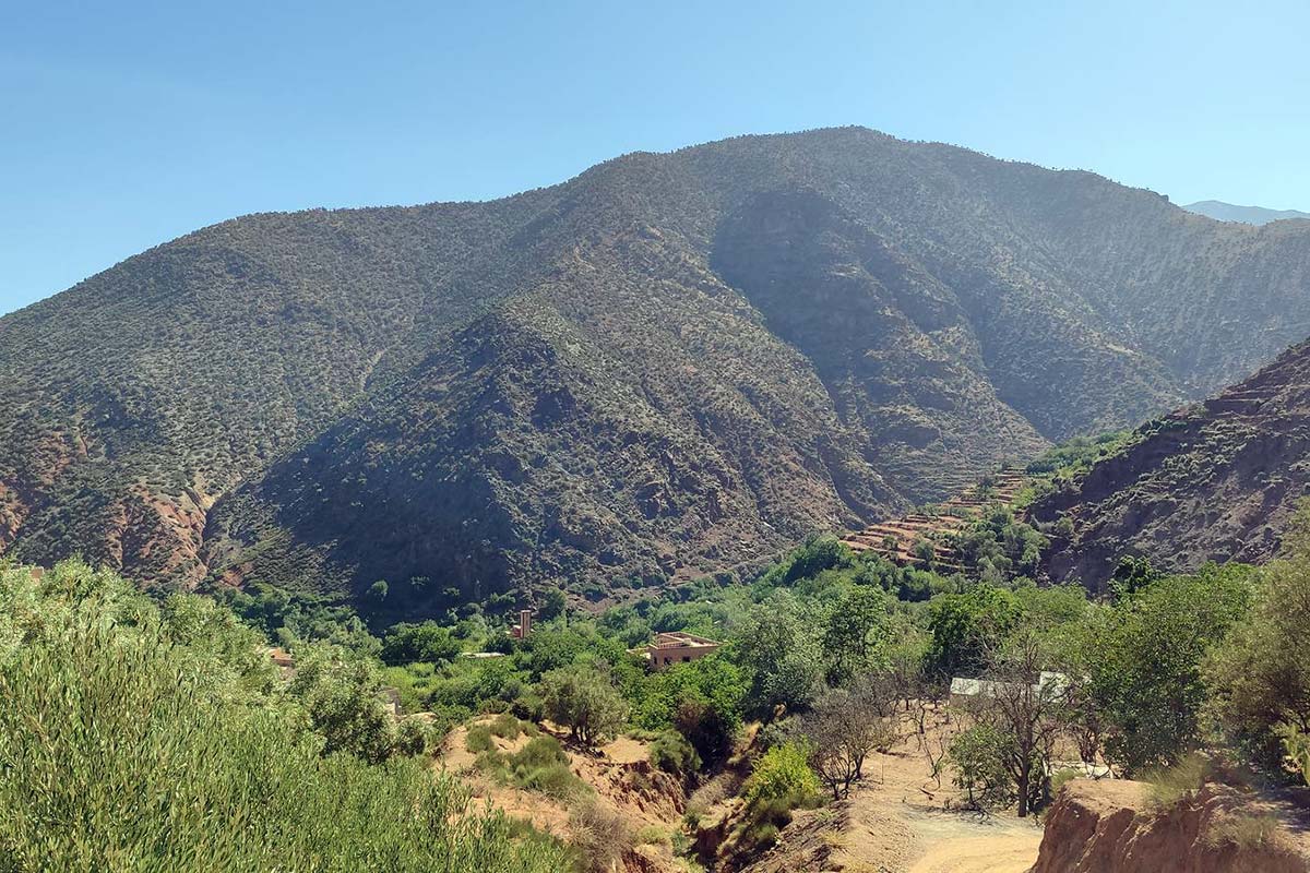
Starting on the Oukaimeden plateau puts the trek's first pass an hour from the trailhead and turns the first day into a long descent through the highest village in the range. The line then runs across the grain of the massif — the Imenane, the Mizane under Toubkal, the Azzaden under Tazaghart — crossing a pass between each valley and leaving the Azzaden by the quiet Tizi Oudite rather than the busy Tizi Mzik. The crossing from Aroumd over Tizi n'Tzikert is the one most Imlil visitors never make, and the optional forty minutes to Adrar El Hadj from the col give the best view of Toubkal on any of our valley treks. Why the Azzaden is worth it: the Azzaden, the scenic route to Toubkal.
Best months for this trek
May–June — green valleys, blossom in the terraces, a plateau in flower; lingering snow on either high col is possible in early May.
July–August — feasible with early starts: the plateau and the cols are cool, the lower valleys hot by midday; afternoon storms can build on the high ground.
September–October — the best window: stable, clear weather and the walnut harvest in every valley.
November–April — Oukaimeden is a ski resort and both high cols are snow passes; the traverse is not run as a standard programme. Month by month: best time to trek the Atlas.
Back down and smiling

Verified trekker reviews

★★★★★
"Starting high on the summer plateau of Oukaimeden at 2,600 m is a brilliant concept—most of the climbing on the first few days is gentle saddles, letting you focus on the sweeping views and cultural encounters. Walking through Tacheddirt, Aroumd, and into the quiet pastures of Azzaden felt like walking through a living postcard."
Jeremy & Sarah Thorne, Bristol, UKTripadvisor • October 2026
★★★★★
"Une superbe randonnée itinérante de 5 jours. Les cols au-dessus de 2 900 m offrent des panoramas éblouissants sur le massif du Toubkal. Les nuits dans les gîtes de village étaient chaleureuses et reposantes, avec de vrais repas traditionnels servis généreusement."
Bernard & Catherine Faure, Marseille, FranceTripadvisor • September 2026
★★★★★
"Five days of pure mountain joy. Having the day's main ascent mostly knocked out by lunchtime left afternoons free for relaxing by mountain streams and sipping fresh mint tea with our guide. Excellent logistics and equipment throughout."
Liam & Chloe Baxter, Sydney, AustraliaTripadvisor • May 2026
Asked before this trek

5-Day Traverse from Oukaimeden to Aguersioual: Imenane, Mizane and Azzaden questions

How hard is this traverse?
Moderate to challenging, with more descent than ascent. Day three is the test — 1,050 m up to Tizi n'Tzikert at 2,930 m and a steep 700 m descent — and the other four days are moderate or easy.
Why start at Oukaimeden?
Because the plateau at 2,620 m puts the first pass an hour from the trailhead and lets the trek run across the grain of the massif, valley by valley, with the day's climbing mostly done by lunchtime.
Can we climb Adrar El Hadj?
Yes, as an optional forty minutes each way from Tizi n'Tzikert on day three, for the best view of Toubkal on any of our valley treks; the guide decides on the day.
Where do we sleep?
In traditional mountain guesthouses in Ouanskra, Aroumd and Tiziane, and at the Tamsoult pastures in a mountain refuge or tents — all selected by Imlil Trek as the best available options.
When is it possible?
May to October, when Tizi n'Ou Addi and Tizi n'Tzikert are snow-free; the best months are May–June and September–October.
Will I see Mount Toubkal?
From Tizi n'Tamatert on day two, from Aroumd that evening, and all the way up to Tizi n'Tzikert on day three.
Do we need a guide?
Yes — a licensed guide is mandatory inside the Toubkal National Park, which the route enters at the first pass. Your guide is included.
Is there phone signal?
At Oukaimeden, Aroumd and Aguersioual; intermittently in the other villages; none at Tamsoult or on the passes.
Read before you book

Guides for this route

  • Oukaimeden guide — Everything you need to know about Oukaimeden — Africa’s highest ski resort (2,600 m to 3,258 m), Bronze Age…
  • Berber villages and gîte life — An authentic guide to traditional Amazigh life in the High Atlas — adobe architecture, walnut irrigation terraces…
  • Trekking the Atlas with children — Family guide to hiking in Morocco with children — child-friendly valley itineraries, riding mules for tired legs…
  • Atlas Mountains packing list — Comprehensive gear checklist for hiking in the High Atlas — 3-season valley trekking vs 4,000 m Toubkal summit…
From €420per person, all-inclusive
Check dates & Book

Your Atlas Adventure Starts with a Conversation

Tell us your dates, your group size, and what kind of experience you’re looking for. We’ll design a trek that fits — no obligation, no pressure, just mountain expertise.

Direct with Certified local Mountain Guides in Imlil — no middleman, transparent pricing.